Area Overview for BH8 8BQ
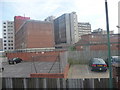
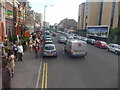
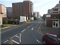
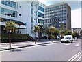
Photos of BH8 8BQ


Area Information
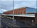
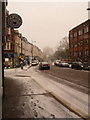
BH8 8BQ is a small residential cluster in Bournemouth, England, with a population of 2,799. Situated in the East Cliff and Springbourne electoral ward, it lies within Bournemouth’s main built-up area, near coordinates 50.7279, -1.86358. The area blends historical charm with modern convenience, centred around Springbourne, a suburb that developed in the Victorian era as a village for craftsmen. Streets like Northcote and Lytton Road feature Victorian cottages, while Edwardian avenues such as Garfield Avenue and Washington Avenue reflect the area’s architectural heritage. The Cricketers Arms pub, dating to 1867, and Springbourne Library, founded in 1909, are local landmarks. Despite its compact size, BH8 8BQ offers proximity to key amenities, including Asda, Lidl, and Bournemouth Railway Station. Its mix of historic character and accessible infrastructure makes it a distinct choice for those seeking a compact, well-connected residential area.
- Area Type
- Postcode
- Area Size
- Not available
- Population
- Not available
- Population Density
- Not available
BH8 8BQ’s property market is characterised by a low home ownership rate of 27%, indicating that the majority of residents rent rather than own their homes. The accommodation type is predominantly flats, which is typical for smaller, urbanised areas. This suggests a housing stock suited to young professionals and students seeking affordable, manageable living spaces. The limited size of the postcode area means the available properties are concentrated, potentially leading to competition among buyers. For those considering purchase, the market may offer opportunities in rental properties, though the small scale of the area means buyers should explore nearby zones for broader options. The prevalence of flats also implies a focus on efficiency and proximity to transport links, which are key features of BH8 8BQ’s appeal.
House Prices in BH8 8BQ
No properties found in this postcode.
Energy Efficiency in BH8 8BQ
Living in BH8 8BQ offers access to a range of amenities within practical reach. Retail options include Asda Bournemouth, Lidl Bournemouth, and other local stores, ensuring daily shopping needs are met. The area’s proximity to Bournemouth Railway Station and Pokesdown Station provides convenient links to the wider region, while ferry landings at Tuckton Tea Gardens and Wick Christchurch offer scenic travel routes. Nearby Bournemouth International Airport enhances accessibility for frequent travellers. The historical character of Springbourne, with its Victorian cottages and Edwardian avenues, complements the modern convenience of these amenities. Residents can enjoy a mix of heritage and practicality, with the Cricketers Arms pub and Springbourne Library adding to the local charm. This blend of retail, transport, and cultural assets supports a lifestyle that balances tradition with contemporary needs.
Amenities
Schools
| Rank | School | Type | Entry gender | Ages |
|---|
Explore more schools in this area
Go to Schools tabDemographics
The population of BH8 8BQ has a median age of 22, with the most common age range being 15–29 years. This indicates a community skewed towards young adults, likely students or early-career professionals. Home ownership stands at 27%, suggesting a rental market dominates, with flats being the predominant accommodation type. The predominant ethnic group is White, reflecting the area’s demographic profile. While specific data on deprivation is not provided, the high proportion of young residents and lower home ownership may imply a transient population. This dynamic community is likely shaped by student influences and temporary housing needs, with social interactions centred around local amenities and transport hubs. The age profile also suggests a demand for affordable, short-term housing options, aligning with the area’s flat-dominated stock.
Household Size
Accommodation Type
Tenure
Ethnic Group
Religion
Household Composition
Age
Household Deprivation
NS-SEC
Explore more demographic insights in this area
Go to Demographics tabPlanning
Planning Constraints
- Flood RiskPremium
- Ramsar Wetland SitesPremium
- Area of Outstanding Natural BeautyPremium
- Protected Nature ReservePremium
- Protected WoodlandPremium