Area Overview for BH8 0LZ
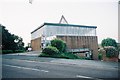
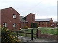
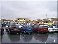
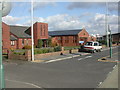
Photos of BH8 0LZ


Area Information
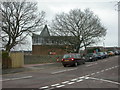
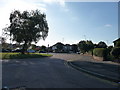
BH8 0LZ lies in the Muscliff and Strouden Park area of Bournemouth, Dorset, a small residential cluster with a population of around 1,760. Historically shaped by 19th-century enclosures and early suburban development, the area sits near the River Stour valley, blending rural and suburban character. Residents benefit from proximity to Strouden Woods, a natural feature offering green space, and roads like Muscliff Road, which trace pre-enclosure pathways. The area is part of the Bournemouth, Christchurch and Poole Council, with three councillors elected since 2019. Daily life here balances quiet residential living with access to nearby amenities, including retail hubs at Castlepoint and transport links to Bournemouth International Airport. The compact nature of BH8 0LZ means it is ideal for those seeking a settled, low-density environment, though its small size limits expansion. Its location in the eastern suburbs of Bournemouth positions it as a practical base for commuters and families, with a focus on local infrastructure and community cohesion.
- Area Type
- Postcode
- Area Size
- Not available
- Population
- Not available
- Population Density
- Not available
The property market in BH8 0LZ is characterised by a 34% home ownership rate, indicating that the majority of properties are rented. This suggests a rental-focused market, possibly due to the area’s historical development and limited new-build housing. The predominant accommodation type is houses, which are more common in older, low-density residential areas. This housing stock may appeal to buyers seeking larger properties with garden space, though the small size of BH8 0LZ means the available options are limited to the immediate vicinity. For buyers, this could mean competition for a limited number of homes, particularly if the area is perceived as a desirable location for its proximity to natural features and transport links. The rental market’s dominance may also influence property values, with potential for growth if demand from commuters or families increases.
House Prices in BH8 0LZ
No properties found in this postcode.
Energy Efficiency in BH8 0LZ
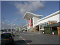
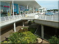
The lifestyle in BH8 0LZ is enriched by nearby amenities that cater to daily needs and leisure. Retail options at Castlepoint include Asda, M&S, and Sainsburys, providing convenience for shopping and dining. Rail stations such as Pokesdown and Bournemouth offer easy access to regional transport networks, while Bournemouth International Airport and ferry landings like Tuckton Tea Gardens support travel by air and water. The area’s proximity to Strouden Woods and historical sites like Muscliff Farm adds a natural and cultural dimension to daily life. These amenities create a balance between practicality and leisure, allowing residents to enjoy both urban conveniences and green spaces. The mix of retail, transport, and recreational options makes BH8 0LZ suitable for those seeking a blend of accessibility and tranquillity.
Amenities
Schools
Residents of BH8 0LZ have access to Townsend Primary and Nursery School, a primary school with no Ofsted rating specified, and Jewell Academy Bournemouth, an academy rated ‘good’ by Ofsted. The mix of school types offers families options for early education and secondary schooling. Townsend Primary caters to younger children, while Jewell Academy provides a broader curriculum for older students. The ‘good’ rating at Jewell Academy suggests a school with strong performance and resources, which may be a key consideration for families prioritising education quality. The proximity of these schools to the area makes BH8 0LZ an attractive option for parents seeking reliable local schooling. However, the lack of specific data on Townsend Primary’s performance means prospective buyers may need to investigate further.
| Rank | School | Type | Entry gender | Ages |
|---|
Explore more schools in this area
Go to Schools tabDemographics
The population of BH8 0LZ has a median age of 47, with the majority of residents aged between 30 and 64 years. This suggests a community of middle-aged and older adults, likely with established careers and families. Home ownership in the area stands at 34%, indicating a rental market dominance, which may reflect the area’s historical development as a residential cluster with limited new housing. The predominant accommodation type is houses, aligning with the older, low-density character of the area. The predominant ethnic group is White, though no specific data on diversity or deprivation is provided. The age profile and home ownership figures suggest a stable, long-term resident base, with fewer young families or transient populations. This demographic profile may influence local services and amenities, tailored to the needs of an older, settled community.
Household Size
Accommodation Type
Tenure
Ethnic Group
Religion
Household Composition
Age
Household Deprivation
NS-SEC
Explore more demographic insights in this area
Go to Demographics tabPlanning
Planning Constraints
- Flood RiskPremium
- Ramsar Wetland SitesPremium
- Area of Outstanding Natural BeautyPremium
- Protected Nature ReservePremium
- Protected WoodlandPremium