Area Overview for BH8 0LD
Photos of BH8 0LD
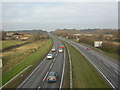
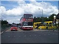
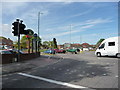
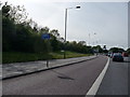
83 photos from this area
Area Information
Key information about the BH8 0LD including its size, population, and administrative classification.
- Area Type
- Postcode
- Area Size
- 3.5 hectares
- Population
- 1437
- Population Density
- 1491 people/km²
House Prices in BH8 0LD
28
Properties
£144,643
Average Sold Price
£56,500
Lowest Price
£255,000
Highest Price
Showing 28 properties
| Address | Type | Beds | Baths | Last Sale Price | Last Sale Date | |
|---|---|---|---|---|---|---|
| 26 Swansbury Drive, Bournemouth, BH8 0LD | house | 2 | - | £255,000 | Oct 2020 | |
| 6 Swansbury Drive, Bournemouth, BH8 0LD | Terraced | 2 | 1 | £234,000 | Jul 2020 | |
| 36 Swansbury Drive, Bournemouth, BH8 0LD | house | 3 | 1 | £175,000 | Mar 2015 | |
| 42 Swansbury Drive, Bournemouth, BH8 0LD | Terraced | 3 | - | £169,000 | Jun 2013 | |
| 12 Swansbury Drive, Bournemouth, BH8 0LD | Terraced | - | - | £165,000 | Apr 2008 | |
| 46 Swansbury Drive, Bournemouth, BH8 0LD | house | - | - | £142,000 | Oct 2006 | |
| 20 Swansbury Drive, Bournemouth, BH8 0LD | Terraced | - | - | £146,000 | Jul 2006 | |
| 40 Swansbury Drive, Bournemouth, BH8 0LD | Terraced | - | - | £156,000 | Oct 2005 | |
| 32 Swansbury Drive, Bournemouth, BH8 0LD | Terraced | - | - | £146,000 | Apr 2005 | |
| 50 Swansbury Drive, Bournemouth, BH8 0LD | Terraced | - | - | £122,000 | Jun 2003 |
Page 1 of 3
Energy Efficiency in BH8 0LD
Amenities
Schools
| Rank | School | Type | Entry gender | Ages |
|---|
Explore more schools in this area
Go to Schools tabDemographics
Household Size
Family (3-5 people)
most common
Accommodation Type
Houses
most common
Tenure
44
majority
Ethnic Group
White
most common
Religion
N/A
most common
Household Composition
N/A
most common
Age
47
median
Adults (30-64 years)
most common
Household Deprivation
N/A
with no deprivation
NS-SEC
23
in Lower managerial occupations
Explore more demographic insights in this area
Go to Demographics tabPlanning
Planning Constraints
- Flood RiskPremium
- Ramsar Wetland SitesPremium
- Area of Outstanding Natural BeautyPremium
- Protected Nature ReservePremium
- Protected WoodlandPremium