Area Overview for BH7 7JR
Photos of BH7 7JR
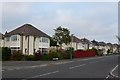
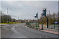
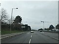
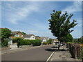
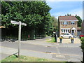
62 photos from this area
Area Information
Key information about the BH7 7JR including its size, population, and administrative classification.
- Area Type
- Postcode
- Area Size
- 1.2 hectares
- Population
- 1653
- Population Density
- 4242 people/km²
House Prices in BH7 7JR
30
Properties
£248,107
Average Sold Price
£79,000
Lowest Price
£415,000
Highest Price
Showing 30 properties
| Address | Type | Beds | Baths | Last Sale Price | Last Sale Date | |
|---|---|---|---|---|---|---|
| 14 Walkwood Avenue, Bournemouth, BH7 7JR | Semi-detached | 3 | 1 | £377,500 | Oct 2025 | |
| 42 Walkwood Avenue, Bournemouth, BH7 7JR | Semi-detached | 3 | 2 | £415,000 | Oct 2024 | |
| 26 Walkwood Avenue, Bournemouth, BH7 7JR | Semi-detached | 2 | 1 | £345,000 | Mar 2024 | |
| 6 Walkwood Avenue, Bournemouth, BH7 7JR | house | 2 | - | £292,000 | Jan 2022 | |
| 4 Walkwood Avenue, Bournemouth, BH7 7JR | Semi-detached | 3 | 1 | £330,000 | Jun 2019 | |
| 12 Walkwood Avenue, Bournemouth, BH7 7JR | Semi-detached | 3 | 1 | £312,000 | Mar 2019 | |
| 16 Walkwood Avenue, Bournemouth, BH7 7JR | house | - | - | £320,000 | Nov 2018 | |
| 54 Walkwood Avenue, Bournemouth, BH7 7JR | Semi-detached | 3 | 1 | £345,000 | Sep 2018 | |
| 38 Walkwood Avenue, Bournemouth, BH7 7JR | Semi-detached | 3 | 1 | £307,500 | Jul 2016 | |
| 48 Walkwood Avenue, Bournemouth, BH7 7JR | house | - | - | £249,500 | Mar 2014 |
Page 1 of 3
Energy Efficiency in BH7 7JR
Amenities
Schools
| Rank | School | Type | Entry gender | Ages |
|---|
Explore more schools in this area
Go to Schools tabDemographics
Household Size
Two person
most common
Accommodation Type
Houses
most common
Tenure
88
majority
Ethnic Group
White
most common
Religion
N/A
most common
Household Composition
N/A
most common
Age
47
median
Adults (30-64 years)
most common
Household Deprivation
N/A
with no deprivation
NS-SEC
42
in Lower managerial occupations
Explore more demographic insights in this area
Go to Demographics tabPlanning
Planning Constraints
- Flood RiskPremium
- Ramsar Wetland SitesPremium
- Area of Outstanding Natural BeautyPremium
- Protected Nature ReservePremium
- Protected WoodlandPremium