Area Overview for BH7 7DA
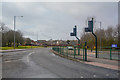
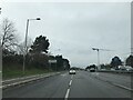
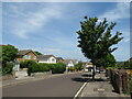
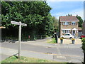
Photos of BH7 7DA
Area Information
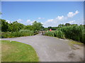
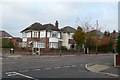
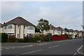
BH7 7DA is a compact residential postcode in Bournemouth, England, covering just 4.6 hectares and home to 1,898 people. Its high population density of 41,527 people per square kilometre reflects a tightly knit community, with most residents living in houses rather than flats. The area falls within the Littledown and Iford electoral ward, historically a farming settlement that transitioned into a suburban hub in the 1980s. Today, it balances modern housing with pockets of green space, including Kings Park and Littledown Leisure Centre. Proximity to the Royal Bournemouth Hospital and Bournemouth County Court underscores its role as a functional suburb. The area’s small size means amenities are within walking distance, while nearby rail stations and ferry landings connect residents to broader regional networks. With a median age of 47, the community is predominantly composed of adults aged 30–64, suggesting a stable, family-oriented demographic. Living here offers a blend of residential comfort and practical connectivity, though the limited area size means development options are constrained.
- Area Type
- Postcode
- Area Size
- 4.6 hectares
- Population
- Not available
- Population Density
- Not available
BH7 7DA is predominantly an owner-occupied area, with 93% of homes owned by residents rather than rented. The accommodation type is almost exclusively houses, reflecting a suburban character with limited high-density development. Given the postcode’s small size of 4.6 hectares, the housing stock is constrained, making it a niche market for buyers seeking established properties. The 1980s-era built environment, including Littledown Leisure Centre and nearby commercial spaces, suggests a mix of residential and functional infrastructure. For buyers, this means limited new developments but proximity to amenities such as the Royal Bournemouth Hospital and Bournemouth County Court. The high home ownership rate indicates a stable market, though the small area size may limit property choice. Those considering the area should prioritise proximity to transport links and existing community facilities, as expansion options are minimal.
House Prices in BH7 7DA
Showing 1 properties
| Address | Type | Beds | Baths | Last Sale Price | Last Sale Date | |
|---|---|---|---|---|---|---|
| Chase Manhatten Bank, 1 Chaseside, Bournemouth, BH7 7DA | Office | - | - | - | - |
Energy Efficiency in BH7 7DA
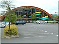
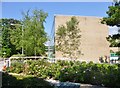
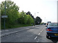
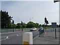
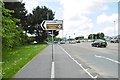
Residents of BH7 7DA have access to a range of amenities within practical reach. The area is served by five retail outlets, including Budgens Spur and Tesco Bournemouth, ensuring everyday shopping needs are met. For transport, five rail stations—such as Christchurch and Bournemouth—provide connections to nearby towns, while ferry landings at Tuckton Tea Gardens and Wick Christchurch offer scenic travel options. The Royal Bournemouth Hospital and Bournemouth County Court are nearby, adding to the area’s functional appeal. Leisure opportunities include Kings Park and Littledown Leisure Centre, offering outdoor and indoor activities. The 1980s-built environment, including JPMorgan’s Chaseside Campus, reflects a mix of residential and commercial use. While the area’s small size means limited expansion, its proximity to amenities and transport links ensures a convenient, self-contained lifestyle.
Amenities
Schools
| Rank | School | Type | Entry gender | Ages |
|---|
Explore more schools in this area
Go to Schools tabDemographics
The population of BH7 7DA is 1,898, with a median age of 47 and the majority of residents aged 30–64. This indicates a mature, established community, likely with many long-term residents. Home ownership is exceptionally high at 93%, with houses being the primary accommodation type. The predominant ethnic group is White, reflecting a relatively homogeneous demographic. The high population density of 41,527 people per square kilometre suggests a compact, densely populated area, which may influence the availability of private outdoor space. While no specific data on deprivation or income levels is provided, the high home ownership rate and age profile imply a stable, middle-income community. The lack of diverse age groups or ethnic representation may affect the vibrancy of local social dynamics, though the area’s proximity to retail, transport, and healthcare facilities supports a functional daily life.
Household Size
Accommodation Type
Tenure
Ethnic Group
Religion
Household Composition
Age
Household Deprivation
NS-SEC
Explore more demographic insights in this area
Go to Demographics tabPlanning
Planning Constraints
- Flood RiskPremium
- Ramsar Wetland SitesPremium
- Area of Outstanding Natural BeautyPremium
- Protected Nature ReservePremium
- Protected WoodlandPremium