Area Overview for BH7 6AE
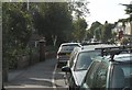
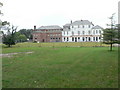
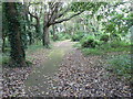
Photos of BH7 6AE

Area Information
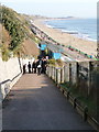
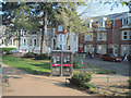
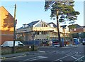
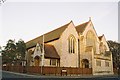
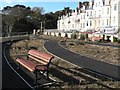
Living in BH7 6AE, a small residential cluster in Bournemouth, Dorset, offers a blend of seaside charm and practical convenience. With a population of 2,142, this area is part of the historically distinct Boscombe suburb, which was incorporated into Bournemouth in 1876 despite local resistance. The community sits near the coast, with easy access to the sea and a mix of architectural styles from Victorian to modernist periods. Notable landmarks include Boscombe Pier, San Remo Towers, and the Chine Gardens, reflecting the area’s heritage as a former seaside resort. Daily life here is shaped by its proximity to transport hubs, including Pokesdown and Bournemouth railway stations, and its connection to nearby ferry services. The area’s compact size means residents are close to amenities, though its small scale also means the housing stock is limited to flats, with a distinct character shaped by its history as a Victorian-era seaside destination.
- Area Type
- Postcode
- Area Size
- Not available
- Population
- Not available
- Population Density
- Not available
The property market in BH7 6AE is characterised by a high concentration of flats, with home ownership at 31%, indicating that the area is more rental-oriented than owner-occupied. This suggests a limited range of housing stock, likely centred on purpose-built or older flats typical of seaside towns. The small size of the area means buyers have few options within BH7 6AE itself, but proximity to nearby Bournemouth and Christchurch could offer additional choices. The prevalence of flats may appeal to those seeking low-maintenance living, though the market’s dynamics are likely influenced by the area’s historical development as a resort. For buyers, this means prioritising proximity to amenities and transport while considering the limited availability of properties in this specific postcode.
House Prices in BH7 6AE
No properties found in this postcode.
Energy Efficiency in BH7 6AE
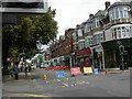
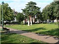
Life in BH7 6AE is shaped by its proximity to shops, transport, and coastal amenities. The area is served by five retail outlets, including Sainsburys, Lidl, and Aldi in nearby Boscombe, offering everyday essentials. Rail stations like Pokesdown and Bournemouth provide access to broader networks, while ferry landings connect to local destinations. The nearby Christchurch Quay and Tuckton Tea Gardens add a maritime dimension to daily life. The area’s seaside location means residents can enjoy coastal walks, historic sites like Boscombe Pier, and the Chine Gardens. With Bournemouth International Airport nearby, travel is straightforward. The mix of retail, transport, and natural features creates a practical, accessible lifestyle, though the small size of the area means residents often venture to adjacent towns for more extensive options.
Amenities
Schools
| Rank | School | Type | Entry gender | Ages |
|---|
Explore more schools in this area
Go to Schools tabDemographics
The demographic profile of BH7 6AE reflects a mature, stable community. The median age is 47, with the most common age range being adults aged 30–64, indicating a population primarily in their prime working years. Home ownership is relatively low at 31%, suggesting a higher proportion of renters, possibly due to the prevalence of flats as the dominant accommodation type. The predominant ethnic group is White, though no specific diversity metrics are provided. The area’s age profile and ownership figures suggest a community that may be more transient or focused on rental living. With no data on deprivation levels, it is unclear how this affects quality of life, but the absence of planning constraints and low flood risk may contribute to a stable environment.
Household Size
Accommodation Type
Tenure
Ethnic Group
Religion
Household Composition
Age
Household Deprivation
NS-SEC
Explore more demographic insights in this area
Go to Demographics tabPlanning
Planning Constraints
- Flood RiskPremium
- Ramsar Wetland SitesPremium
- Area of Outstanding Natural BeautyPremium
- Protected Nature ReservePremium
- Protected WoodlandPremium