Area Overview for BH6 5NQ
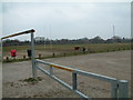
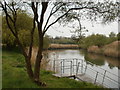
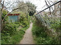
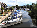
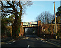
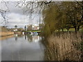
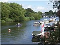
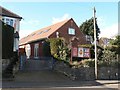
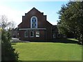
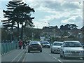
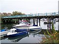
Photos of BH6 5NQ

Area Information
BH6 5NQ lies in the heart of East Southbourne and Tuckton, a small residential cluster within Bournemouth, Christchurch and Poole. With a population of 1,800, it is a tight-knit area characterised by its proximity to the River Stour and historical sites like Tuckton Bridge. The ward’s origins trace back to the 13th century, with Tuckton Farm land developed in the 19th century by the Southbourne-on-Sea Freehold Land Company. Today, it blends heritage with modern living, offering homes near the River Stour’s lowest bridging point and Tuckton Tea Gardens, a 1903 site now managed by the council. Daily life here is shaped by its coastal location, with easy access to Christchurch Quay and Bournemouth International Airport. The area’s small size means a strong sense of community, with residents benefiting from nearby amenities, including five retail outlets and three railway stations. Its mix of historical charm and practical connectivity makes it appealing to those seeking a balance between tradition and convenience.
- Area Type
- Postcode
- Area Size
- Not available
- Population
- 1800
- Population Density
- 3789 people/km²
BH6 5NQ is a predominantly owner-occupied area, with 83% of homes owned by residents rather than rented. The accommodation type is primarily houses, which contrasts with areas dominated by flats or apartments. This suggests a housing stock suited to families or individuals seeking more space, though the small size of the postcode means the number of properties is limited. Buyers should consider the area’s proximity to amenities like Christchurch Railway Station and Bournemouth International Airport, which enhance its appeal for commuters or those requiring transport links. The high home ownership rate indicates a stable market, but the small size of the area means inventory is constrained. For buyers, this could mean competition for available properties, though the mix of historical and modern homes offers varied options.
House Prices in BH6 5NQ
No properties found in this postcode.
Energy Efficiency in BH6 5NQ
Residents of BH6 5NQ have access to a range of amenities within practical reach. Retail options include Tesco Tuckton, Co-op Southbourne, and Asda Christchurch, providing everyday shopping needs. The area’s ferry landings, such as Christchurch Quay and Wick Christchurch, offer scenic routes and links to local attractions. Rail stations like Christchurch and Bournemouth provide swift access to the wider region. The historical character of the area, including Tuckton Bridge and Tuckton Tea Gardens, adds to its charm. The mix of shops, transport, and heritage sites creates a lifestyle that balances convenience with a connection to the past, ideal for those valuing both practicality and local history.
Amenities
Schools
The nearest school to BH6 5NQ is Bournemouth Christian School, an independent institution. No state schools are listed in the data, which means families relying on free education may need to look beyond the immediate area. The presence of an independent school suggests the area attracts households prioritising private education, though it also highlights a potential gap in local state school provision. Parents considering BH6 5NQ should assess whether the independent school meets their needs or if they require additional transport arrangements for state schooling elsewhere. The absence of other schools in the data means the educational landscape here is limited to this single option.
| Rank | School | Type | Entry gender | Ages |
|---|
Explore more schools in this area
Go to Schools tabDemographics
The population of BH6 5NQ is predominantly adults aged 30–64, with a median age of 47. This suggests a mature, stable community, likely with established families and professionals. Home ownership is high at 83%, indicating a strong preference for long-term residency over renting. The area is largely composed of houses, reflecting a residential profile suited to families rather than flats or shared housing. The predominant ethnic group is White, which aligns with broader trends in the region. The absence of specific data on deprivation or diversity metrics means the community’s social dynamics are not quantified, but the high home ownership and age profile imply a low turnover of residents and a focus on settled living. This demographic structure likely supports local services and amenities tailored to older and middle-aged populations.
Household Size
Accommodation Type
Tenure
Ethnic Group
Religion
Household Composition
Age
Household Deprivation
NS-SEC
Explore more demographic insights in this area
Go to Demographics tabPlanning
Planning Constraints
- Flood RiskPremium
- Ramsar Wetland SitesPremium
- Area of Outstanding Natural BeautyPremium
- Protected Nature ReservePremium
- Protected WoodlandPremium