Area Overview for BH6 5NE
Photos of BH6 5NE
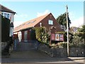
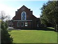
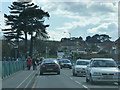
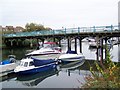
100 photos from this area
Area Information
Key information about the BH6 5NE including its size, population, and administrative classification.
- Area Type
- Postcode
- Area Size
- 2.0 hectares
- Population
- Not available
- Population Density
- Not available
House Prices in BH6 5NE
39
Properties
£284,473
Average Sold Price
£64,000
Lowest Price
£515,000
Highest Price
Showing 39 properties
| Address | Type | Beds | Baths | Last Sale Price | Last Sale Date | |
|---|---|---|---|---|---|---|
| 164 Iford Lane, Bournemouth, BH6 5NE | Semi-detached | 3 | 1 | £515,000 | Jan 2025 | |
| 192 Iford Lane, Bournemouth, BH6 5NE | Semi-detached | 3 | 1 | £510,000 | Nov 2024 | |
| 158 Iford Lane, Bournemouth, BH6 5NE | house | - | - | £505,000 | Aug 2022 | |
| 176 Iford Lane, Bournemouth, BH6 5NE | Semi-detached | 3 | 1 | £470,000 | Feb 2022 | |
| 202 Iford Lane, Bournemouth, BH6 5NE | house | - | - | £380,000 | Nov 2021 | |
| 174 Iford Lane, Bournemouth, BH6 5NE | Semi-detached | 3 | 1 | £408,500 | Feb 2021 | |
| 162 Iford Lane, Bournemouth, BH6 5NE | house | - | - | £315,000 | Jan 2020 | |
| 216 Iford Lane, Bournemouth, BH6 5NE | house | - | - | £361,000 | Jul 2019 | |
| 188 Iford Lane, Bournemouth, BH6 5NE | Semi-detached | 3 | 2 | £368,500 | Nov 2018 | |
| 210 Iford Lane, Bournemouth, BH6 5NE | house | - | - | £315,000 | Jul 2016 |
Page 1 of 4
Energy Efficiency in BH6 5NE
Amenities
Schools
| Rank | School | Type | Entry gender | Ages |
|---|
Explore more schools in this area
Go to Schools tabDemographics
Household Size
Family (3-5 people)
most common
Accommodation Type
Houses
most common
Tenure
52
majority
Ethnic Group
White
most common
Religion
N/A
most common
Household Composition
N/A
most common
Age
47
median
Adults (30-64 years)
most common
Household Deprivation
N/A
with no deprivation
NS-SEC
29
in Lower managerial occupations
Explore more demographic insights in this area
Go to Demographics tabPlanning
Planning Constraints
- Flood RiskPremium
- Ramsar Wetland SitesPremium
- Area of Outstanding Natural BeautyPremium
- Protected Nature ReservePremium
- Protected WoodlandPremium