Area Overview for BH6 3YD
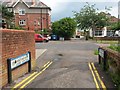
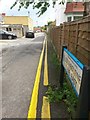
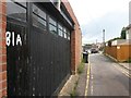
Photos of BH6 3YD

Area Information
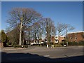
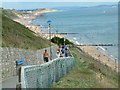
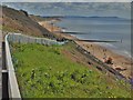
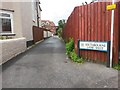
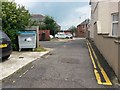
Living in BH6 3YD means residing in a small, defined residential cluster within the Southbourne suburb of Bournemouth, near the River Stour. This area, part of the East Southbourne and Tuckton electoral ward, has a population of 1,506, reflecting its compact nature. Historically, it evolved from 19th-century developments, including Tuckton Farm land acquired in 1871 and early 20th-century infrastructure like Tuckton Bridge, which remains a notable landmark. Daily life here balances suburban tranquillity with proximity to amenities. Residents benefit from nearby ferry landings, rail stations, and retail hubs, while the area’s low crime risk and minimal environmental constraints make it appealing. The community is characterised by a mature demographic, with a median age of 47, suggesting a stable, established population. For buyers, BH6 3YD offers a focused, low-density living environment, ideal for those seeking a quieter, well-connected corner of Bournemouth.
- Area Type
- Postcode
- Area Size
- Not available
- Population
- Not available
- Population Density
- Not available
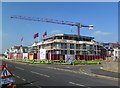
The property market in BH6 3YD is characterised by a high rate of home ownership (69%) and a predominance of flats. This suggests a mix of owner-occupied properties and rental units, though the exact proportion of rentals is not specified. The concentration of flats indicates a housing stock likely developed in the mid-to-late 20th century, aligned with the area’s historical growth. Buyers should consider that the small population and limited area size mean housing options are constrained, with little scope for new developments. The market is likely to cater to those seeking compact, well-connected living without the density of larger urban centres. For investors, the stability of the existing stock and proximity to transport links may offer long-term value.
House Prices in BH6 3YD
No properties found in this postcode.
Energy Efficiency in BH6 3YD
Residents of BH6 3YD have access to a range of amenities within walking or short driving distance. Retail options include Sainsburys Bournemouth, Co-op Southbourne, and The Southern Co-operative Co, ensuring everyday shopping needs are met. The area’s proximity to ferry landings like Tuckton Tea Gardens and Christchurch Quay adds a maritime dimension to daily life, offering scenic routes and potential for leisure activities. Rail stations such as Christchurch and Bournemouth provide links to broader transport networks, while nearby airports cater to travel needs. The blend of retail, transport, and waterfront access creates a convenient, varied lifestyle, balancing suburban comfort with connectivity to larger urban amenities.
Amenities
Schools
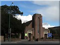
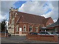
The nearest school to BH6 3YD is St Mary’s Gate School, an independent institution. While no Ofsted rating is provided, the presence of an independent school suggests a range of educational options for families. The area’s small size means it is served by a single primary or secondary school, which may require commuting to nearby towns for higher education. For families prioritising independent schooling, St Mary’s Gate offers a private alternative, though the lack of state school data means buyers should verify additional options. The school’s type reflects the area’s demographic profile, likely catering to the needs of the mature, established community.
| Rank | School | Type | Entry gender | Ages |
|---|
Explore more schools in this area
Go to Schools tabDemographics
The community in BH6 3YD is predominantly composed of adults aged 30–64, with a median age of 47. Home ownership rates are high at 69%, indicating a strong presence of long-term residents. The area’s accommodation is largely flats, reflecting a mix of older housing stock and post-war developments. The predominant ethnic group is White, though specific diversity metrics are not detailed. The demographic profile suggests a mature, settled population, likely with established careers and family ties. With no data on deprivation levels, the area’s quality of life appears supported by its low crime risk and proximity to essential services. The age distribution implies a community with a balance of active professionals and retirees, contributing to a stable local economy.
Household Size
Accommodation Type
Tenure
Ethnic Group
Religion
Household Composition
Age
Household Deprivation
NS-SEC
Explore more demographic insights in this area
Go to Demographics tabPlanning
Planning Constraints
- Flood RiskPremium
- Ramsar Wetland SitesPremium
- Area of Outstanding Natural BeautyPremium
- Protected Nature ReservePremium
- Protected WoodlandPremium