Area Overview for BH6 3SR
Photos of BH6 3SR

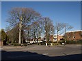
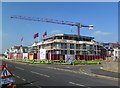
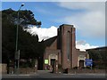
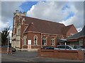
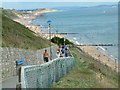
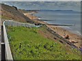
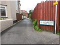
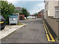
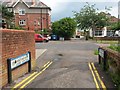
100 photos from this area
Area Information
Key information about the BH6 3SR including its size, population, and administrative classification.
- Area Type
- Postcode
- Area Size
- 1.3 hectares
- Population
- Not available
- Population Density
- Not available
House Prices in BH6 3SR
74
Properties
£1,598,792
Average Sold Price
£100,000
Lowest Price
£14,125,000
Highest Price
Showing 74 properties
| Address | Type | Beds | Baths | Last Sale Price | Last Sale Date | |
|---|---|---|---|---|---|---|
| 15 Southern Road, Bournemouth, BH6 3SR | house | 7 | - | £1,060,000 | Jul 2022 | |
| 25 Southern Road, Bournemouth, BH6 3SR | Detached | 9 | 2 | £615,000 | Jun 2019 | |
| 16 Southern Road, Bournemouth, BH6 3SR | house | - | - | £585,000 | Jun 2017 | |
| 7 Southern Road, Bournemouth, BH6 3SR | Detached | 7 | 2 | £14,125,000 | Dec 2016 | |
| 27 Southern Road, Bournemouth, BH6 3SR | Detached | 6 | 1 | £615,000 | Dec 2016 | |
| 9 Southern Road, Bournemouth, BH6 3SR | Flat | - | - | £269,500 | Jun 2016 | |
| 1A Southern Road, Bournemouth, BH6 3SR | Flat | - | - | £219,000 | Dec 2014 | |
| 22 Southern Road, Bournemouth, BH6 3SR | Detached | - | - | £390,000 | Aug 2011 | |
| 10 Southern Road, Bournemouth, BH6 3SR | Flat | - | - | £485,000 | Jun 2007 | |
| 13 Southern Road, Bournemouth, BH6 3SR | Detached | 4 | 3 | £400,000 | Apr 2007 |
Page 1 of 8
Energy Efficiency in BH6 3SR
Amenities
Schools
| Rank | School | Type | Entry gender | Ages |
|---|
Explore more schools in this area
Go to Schools tabDemographics
Household Size
One person
most common
Accommodation Type
Flats
most common
Tenure
49
majority
Ethnic Group
White
most common
Religion
N/A
most common
Household Composition
N/A
most common
Age
47
median
Adults (30-64 years)
most common
Household Deprivation
N/A
with no deprivation
NS-SEC
36
in Lower managerial occupations
Explore more demographic insights in this area
Go to Demographics tabPlanning
Planning Constraints
- Flood RiskPremium
- Ramsar Wetland SitesPremium
- Area of Outstanding Natural BeautyPremium
- Protected Nature ReservePremium
- Protected WoodlandPremium