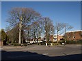
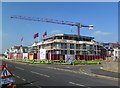
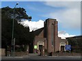
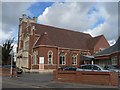
Area Overview for BH6 3RW
Photos of BH6 3RW

Area Information
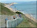
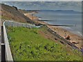
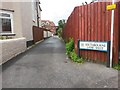
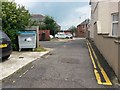
BH6 3RW is a small residential postcode cluster in Bournemouth, Dorset, nestled within the West Southbourne Ward. This area lies between Boscombe East and Pokesdown to the east, and East Southbourne and Tuckton to the west. With a population of 1,622, it reflects the character of Southbourne, a historic suburb developed as a health resort in the 19th century. The area is part of the broader Bournemouth conurbation, offering a mix of suburban living and proximity to coastal and urban amenities. Daily life here is shaped by its compact size and integration with nearby towns. Residents benefit from easy access to Bournemouth International Airport, rail networks, and ferry services, which connect them to wider regional hubs. The area’s history as a health resort still influences its appeal, with a focus on accessible green spaces and community-focused infrastructure. For those seeking a balance between quiet residential living and practical connectivity, BH6 3RW offers a distinct blend of small-town charm and modern convenience.
- Area Type
- Postcode
- Area Size
- Not available
- Population
- 1622
- Population Density
- 7908 people/km²
The property market in BH6 3RW is characterised by a 46% home ownership rate, with flats making up the majority of accommodation types. This suggests a rental-oriented market, where a substantial portion of the housing stock is leased rather than owned. The prevalence of flats indicates a focus on compact, efficient living, which may appeal to professionals or families seeking manageable, low-maintenance homes. However, the small size of the postcode and the concentration of flats could limit availability for buyers seeking larger properties or detached housing. For those considering the area, the market’s rental bias means competition for owner-occupied homes may be higher. Proximity to transport links and amenities likely contributes to the area’s appeal, though buyers should assess whether the flat-based stock aligns with their long-term needs.
House Prices in BH6 3RW
No properties found in this postcode.
Energy Efficiency in BH6 3RW
Living in BH6 3RW offers a range of amenities within practical reach. Retail options include major supermarkets like Tesco Southbourne, Co-op Southbourne, and Sainsburys Bournemouth, ensuring everyday shopping needs are met. The area’s rail stations, such as Pokesdown and Bournemouth, provide easy access to urban centres, while ferry landings at Tuckton Tea Gardens and Christchurch Quay connect residents to coastal and riverine routes. The proximity to Bournemouth International Airport adds to the area’s appeal for frequent travellers. The mix of retail, transport, and leisure options creates a convenient lifestyle, blending suburban comfort with urban accessibility. These amenities support a dynamic daily life, whether for commuting, shopping, or exploring nearby attractions.
Amenities
Schools
| Rank | School | Type | Entry gender | Ages |
|---|
Explore more schools in this area
Go to Schools tabDemographics
The community in BH6 3RW is predominantly composed of adults aged 30–64, with a median age of 47. This suggests a mature population, likely with established careers and family ties. Home ownership stands at 46%, indicating a mix of owner-occupied and rental properties. The accommodation type is primarily flats, reflecting a housing stock tailored to smaller households or those seeking urban living. The predominant ethnic group is White, with no specific data on other demographics provided. The absence of detailed diversity statistics means the area’s cultural composition remains less defined in the data. For quality of life, the median age and home ownership rate suggest a stable, settled community, though the 46% ownership rate implies a significant portion of residents may be renters, potentially affecting long-term investment prospects.
Household Size
Accommodation Type
Tenure
Ethnic Group
Religion
Household Composition
Age
Household Deprivation
NS-SEC
Explore more demographic insights in this area
Go to Demographics tabPlanning
Planning Constraints
- Flood RiskPremium
- Ramsar Wetland SitesPremium
- Area of Outstanding Natural BeautyPremium
- Protected Nature ReservePremium
- Protected WoodlandPremium