Area Overview for BH6 3RE
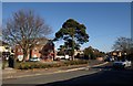
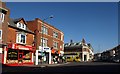
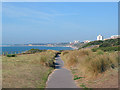
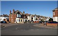
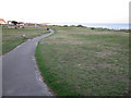
Photos of BH6 3RE


Area Information
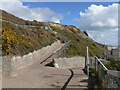
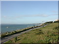
BH6 3RE is a compact residential postcode nestled in the West Southbourne Ward of Bournemouth, Dorset. Covering just 744 square metres, it is a densely populated area with 1,622 residents, translating to a staggering 2.18 million people per square kilometre. This small cluster lies within the broader Bournemouth conurbation, historically developed as a health resort in the 19th century. Today, it blends suburban comfort with coastal proximity, bordered by areas like Pokesdown and Tuckton. Daily life here is shaped by its proximity to retail hubs, rail networks, and ferry services. Residents benefit from nearby supermarkets such as Co-op Southbourne and Sainsburys Bournemouth, while rail stations like Pokesdown and Bournemouth offer easy access to regional centres. The area’s compact size means amenities are within practical reach, though its high density reflects a mix of long-standing residents and newer developments. For buyers, BH6 3RE offers a slice of Bournemouth’s heritage with modern connectivity, though its small footprint means choices are limited to the immediate vicinity.
- Area Type
- Postcode
- Area Size
- 744 m²
- Population
- 1622
- Population Density
- 7908 people/km²
The property market in BH6 3RE is characterised by a 46% home ownership rate, with flats making up the majority of housing stock. This suggests a rental market complementing owner-occupied properties, though the small area size limits the variety of available homes. The prevalence of flats indicates a focus on space efficiency, which may appeal to buyers seeking affordability over expansive living areas. Given the postcode’s compact footprint, property choices are constrained to the immediate vicinity, with little scope for expansion. Buyers should consider the area’s high density when evaluating potential properties, as it may influence both price and availability. While flats dominate, the lack of data on specific property types or price ranges means buyers must rely on local agents for detailed insights. The market likely reflects broader Bournemouth trends, with a blend of older and newer developments catering to different needs.
House Prices in BH6 3RE
Showing 1 properties
| Address | Type | Beds | Baths | Last Sale Price | Last Sale Date | |
|---|---|---|---|---|---|---|
| Richard Godsell, 3A Southbourne Grove, Bournemouth, BH6 3RE | retail_financial | - | - | - | - |
Energy Efficiency in BH6 3RE
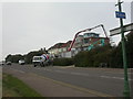
Living in BH6 3RE offers access to a range of amenities within walking or short driving distance. Retail options include major supermarkets like Co-op Southbourne, Tesco Southbourne, and Sainsburys Bournemouth, ensuring daily shopping needs are met. The area’s rail network connects to Pokesdown, Christchurch, and Bournemouth stations, providing links to cultural, employment, and leisure opportunities. Ferry landings such as Tuckton Tea Gardens and Wick Christchurch offer proximity to coastal activities, while nearby airports cater to regional and international travel. Though the area is small, its strategic location within Bournemouth means residents can enjoy the town’s attractions, from beaches to historic sites. The mix of retail, transport, and coastal access creates a lifestyle that balances convenience with the charm of a smaller community, though the high density may limit private outdoor space.
Amenities
Schools
| Rank | School | Type | Entry gender | Ages |
|---|
Explore more schools in this area
Go to Schools tabDemographics
The community in BH6 3RE is predominantly composed of adults aged 30–64, with a median age of 47. This suggests a mature, stable population, likely with established careers and families. Home ownership rates stand at 46%, indicating a mix of owner-occupied properties and rental units. The accommodation type is primarily flats, reflecting a trend common in high-density urban areas. The predominant ethnic group is White, though specific diversity statistics are not provided. The high population density—over 2 million per square kilometre—raises questions about living conditions, though the area’s small size means residents are closely knit. This demographic profile suggests a community focused on practical living, with limited space for sprawling homes but ample access to nearby services. The age range implies a balance between working professionals and retirees, shaping the area’s pace of life.
Household Size
Accommodation Type
Tenure
Ethnic Group
Religion
Household Composition
Age
Household Deprivation
NS-SEC
Explore more demographic insights in this area
Go to Demographics tabPlanning
Planning Constraints
- Flood RiskPremium
- Ramsar Wetland SitesPremium
- Area of Outstanding Natural BeautyPremium
- Protected Nature ReservePremium
- Protected WoodlandPremium