Area Overview for BH4 8JF
Photos of BH4 8JF
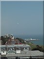
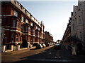
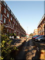
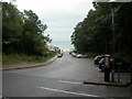
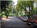
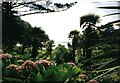
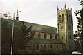
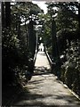
100 photos from this area
Area Information
Key information about the BH4 8JF including its size, population, and administrative classification.
- Area Type
- Postcode
- Area Size
- 1.7 hectares
- Population
- Not available
- Population Density
- Not available
House Prices in BH4 8JF
90
Properties
£506,750
Average Sold Price
£174,000
Lowest Price
£1,310,000
Highest Price
Showing 90 properties
| Address | Type | Beds | Baths | Last Sale Price | Last Sale Date | |
|---|---|---|---|---|---|---|
| 4, Sandbourne House, 19 Burnaby Road, Bournemouth, BH4 8JF | Flat | - | - | £218,000 | Jun 2021 | |
| 1, Alum Grange, 1 Burnaby Road, Bournemouth, BH4 8JF | Flat | 14 | 13 | £1,310,000 | Dec 2017 | |
| 4, Alum Grange, 1 Burnaby Road, Bournemouth, BH4 8JF | Flat | - | - | £325,000 | Aug 2017 | |
| 5 Burnaby Road, Bournemouth, BH4 8JF | Flat | 2 | 2 | £174,000 | Apr 1997 | |
| Flat 2, 11 Burnaby Road, Bournemouth, BH4 8JF | Flat | 3 | 2 | - | - | |
| Flat 4, 4 Burnaby Road, Bournemouth, BH4 8JF | Flat | 2 | 1 | - | - | |
| Flat 4, 24 Burnaby Road, Bournemouth, BH4 8JF | Flat | 2 | 1 | - | - | |
| Flat 2, 18 Burnaby Road, Bournemouth, BH4 8JF | Flat | 2 | 1 | - | - | |
| 5, Alum Grange, 1 Burnaby Road, Bournemouth, BH4 8JF | Flat | 2 | 2 | - | - | |
| Flat 3, 29 Burnaby Road, Bournemouth, BH4 8JF | Flat | 2 | 1 | - | - |
Page 1 of 9
Energy Efficiency in BH4 8JF
Amenities
Schools
| Rank | School | Type | Entry gender | Ages |
|---|
Explore more schools in this area
Go to Schools tabDemographics
Household Size
Two person
most common
Accommodation Type
Flats
most common
Tenure
57
majority
Ethnic Group
White
most common
Religion
N/A
most common
Household Composition
N/A
most common
Age
47
median
Adults (30-64 years)
most common
Household Deprivation
N/A
with no deprivation
NS-SEC
51
in Lower managerial occupations
Explore more demographic insights in this area
Go to Demographics tabPlanning
Planning Constraints
- Flood RiskPremium
- Ramsar Wetland SitesPremium
- Area of Outstanding Natural BeautyPremium
- Protected Nature ReservePremium
- Protected WoodlandPremium