Area Overview for BH4 8DZ
Photos of BH4 8DZ
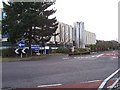
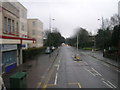
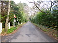
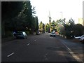
99 photos from this area
Area Information
Key information about the BH4 8DZ including its size, population, and administrative classification.
- Area Type
- Postcode
- Area Size
- 4492 m²
- Population
- Not available
- Population Density
- Not available
House Prices in BH4 8DZ
31
Properties
£381,250
Average Sold Price
£165,000
Lowest Price
£650,000
Highest Price
Showing 31 properties
| Address | Type | Beds | Baths | Last Sale Price | Last Sale Date | |
|---|---|---|---|---|---|---|
| 58A Alum Chine Road, Bournemouth, BH4 8DZ | Maisonette | 2 | - | £300,000 | Jun 2020 | |
| 52 Alum Chine Road, Bournemouth, BH4 8DZ | Detached | 5 | 3 | £650,000 | Jun 2019 | |
| 58 Alum Chine Road, Bournemouth, BH4 8DZ | Flat | - | - | £165,000 | Jun 2011 | |
| 60 Alum Chine Road, Bournemouth, BH4 8DZ | house | 5 | - | £410,000 | Apr 2007 | |
| Flat 5, 56 Alum Chine Road, Bournemouth, BH4 8DZ | Flat | 2 | 2 | - | - | |
| 3, Chine Walk House, 66 Alum Chine Road, Bournemouth, BH4 8DZ | Flat | 6 | 3 | - | - | |
| Flat 1, 64 Alum Chine Road, Bournemouth, BH4 8DZ | Semi-detached | 6 | - | - | - | |
| 1, Chine Walk House, 66 Alum Chine Road, Bournemouth, BH4 8DZ | Flat | 2 | - | - | - | |
| Flat 1, 54 Alum Chine Road, Bournemouth, BH4 8DZ | Flat | - | - | - | - | |
| 5, Chine Walk House, 66 Alum Chine Road, Bournemouth, BH4 8DZ | Flat | - | - | - | - |
Page 1 of 4
Energy Efficiency in BH4 8DZ
Amenities
Schools
| Rank | School | Type | Entry gender | Ages |
|---|
Explore more schools in this area
Go to Schools tabDemographics
Household Size
One person
most common
Accommodation Type
Flats
most common
Tenure
33
majority
Ethnic Group
White
most common
Religion
N/A
most common
Household Composition
N/A
most common
Age
47
median
Adults (30-64 years)
most common
Household Deprivation
N/A
with no deprivation
NS-SEC
35
in Lower managerial occupations
Explore more demographic insights in this area
Go to Demographics tabPlanning
Planning Constraints
- Flood RiskPremium
- Ramsar Wetland SitesPremium
- Area of Outstanding Natural BeautyPremium
- Protected Nature ReservePremium
- Protected WoodlandPremium