Area Overview for BH31 7YD
Photos of BH31 7YD


Area Information
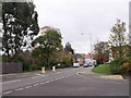
Living in BH31 7YD, a small residential cluster in eastern Dorset, means being part of a community rooted in history yet evolving with modern needs. The postcode covers Verwood, a town with a population of 1,969, nestled near the Hampshire border. Historically tied to pottery, brick-making, and heathland trades, Verwood has grown from a scattered settlement into a town of around 15,000 people, though local data suggests a smaller current population. Its proximity to Ringwood, Bournemouth, and Poole offers easy access to larger towns without sacrificing the charm of a quieter, characterful locale. The River Crane, which becomes the Moors River, adds natural appeal, while landmarks like Stephen’s Castle and the Verwood Memorial Hall reflect its heritage. Daily life here balances small-town convenience with nearby amenities, making it a practical choice for those seeking stability and a connection to the past.
- Area Type
- Postcode
- Area Size
- Not available
- Population
- Not available
- Population Density
- Not available
The property market in BH31 7YD is characterised by a high rate of home ownership (77%) and a predominance of houses. This suggests a community where long-term residency is common, with properties likely to be family homes rather than investment properties. The small size of the area means housing stock is limited, which could make the market competitive for buyers seeking options. Given the focus on houses, buyers should expect a mix of traditional and modern builds, though the absence of flats or apartments may limit choices for those preferring urban-style living. Proximity to nearby towns like Ringwood or Bournemouth could be a draw for those needing more property diversity.
House Prices in BH31 7YD
No properties found in this postcode.
Energy Efficiency in BH31 7YD
Residents of BH31 7YD have access to essential amenities within practical reach, including retail options like Tesco Verwood, Morrisons Verwood, and Lidl Verwood. These stores provide convenience for daily shopping and groceries. The area’s natural surroundings, such as the River Crane and nearby heathland, offer opportunities for walking, cycling, or leisurely outdoor activities. Historical sites like Stephen’s Castle and the Verwood Memorial Hall add cultural value, while the town’s small-scale character fosters a sense of community. Though the area lacks an upper school, recent infrastructure developments suggest efforts to meet local needs. The blend of practical amenities and natural beauty supports a lifestyle that balances convenience with tranquillity.
Amenities
Schools
| Rank | School | Type | Entry gender | Ages |
|---|
Explore more schools in this area
Go to Schools tabDemographics
The population of BH31 7YD is 1,969, with a median age of 47, indicating a community skewed toward adults aged 30–64. Home ownership is high at 77%, suggesting a stable, long-term resident base. The majority of properties are houses, reflecting a preference for standalone living rather than flats or apartments. The predominant ethnic group is White, with no specific data on diversity beyond this. The age profile and ownership figures point to a mature, settled population, likely with strong family ties and a focus on long-term residency. This demographic profile aligns with a quality of life that prioritises comfort, security, and community continuity over transient living.
Household Size
Accommodation Type
Tenure
Ethnic Group
Religion
Household Composition
Age
Household Deprivation
NS-SEC
Explore more demographic insights in this area
Go to Demographics tabPlanning
Planning Constraints
- Flood RiskPremium
- Ramsar Wetland SitesPremium
- Area of Outstanding Natural BeautyPremium
- Protected Nature ReservePremium
- Protected WoodlandPremium