Area Overview for BH31 7YA
Photos of BH31 7YA


Area Information
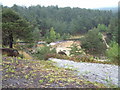
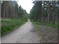
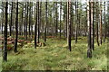
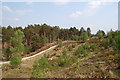
BH31 7YA is a small, tightly knit residential area in eastern Dorset, near the Hampshire border. It sits within Verwood, a town with a history rooted in heathland and clay-based industries, now evolving into a growing community of around 15,000 residents. The postcode covers a cluster of homes with a population of 1,452, spread across 1.95 km², creating a dense yet intimate living environment. Verwood’s proximity to Ringwood, Bournemouth, and Poole offers easy access to larger towns without sacrificing the charm of a smaller settlement. Daily life here is shaped by its rural surroundings, with the River Crane and nearby heathland influencing the local character. The area is served by essential amenities, including supermarkets like Tesco Verwood and Morrisons Verwood, and a range of primary schools. While it lacks an upper school, the presence of academies and community schools suggests a focus on local education. The mix of historic and modern infrastructure, from the 1829 cob church to recent retail developments, reflects Verwood’s dual identity as a town with deep roots and ongoing growth.
- Area Type
- Postcode
- Area Size
- Not available
- Population
- 1452
- Population Density
- 737 people/km²
BH31 7YA is predominantly an owner-occupied area, with 85% of homes owned by residents rather than rented. The accommodation type is primarily houses, which is typical for smaller, rural postcode areas. This suggests a housing stock that caters to families, with larger properties and gardens, contrasting with urban centres where flats dominate. The high home ownership rate implies a stable market with long-term residents, reducing turnover and fostering a sense of community. However, the small size of the area—covering just 1.95 km²—means the housing stock is limited, and buyers may need to look beyond BH31 7YA itself for additional options. The focus on houses also means the area is less suited to investors seeking rental income, though the proximity to Verwood’s retail and service amenities may support local demand.
House Prices in BH31 7YA
No properties found in this postcode.
Energy Efficiency in BH31 7YA
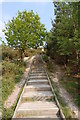
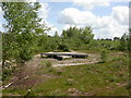
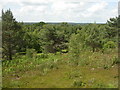
Residents of BH31 7YA have access to a range of nearby amenities within practical reach. The area is served by five retail outlets, including major supermarkets like Tesco Verwood, Lidl Verwood, and Morrisons Verwood, ensuring daily shopping needs are met. The town’s historic heathland and proximity to the River Crane provide opportunities for outdoor activities, though specific parks or leisure facilities are not detailed in the data. The presence of the Verwood Memorial Hall, opened in 1959, suggests community events and social gatherings are possible. The mix of retail, historical sites, and natural surroundings creates a lifestyle that balances convenience with rural tranquillity, though the lack of detailed information on dining or leisure options means further local research may be needed for a complete picture.
Amenities
Schools
The area is served by several primary schools, including Hillside Community First School and Trinity CofE VA First School, both of which operate as academies. The latter, Trinity Church of England First School, holds a ‘good’ Ofsted rating, indicating a reliable standard of education. The presence of multiple primary schools suggests strong local provision for young families, though the absence of an upper school means students must travel to nearby towns like Ringwood or Bournemouth for secondary education. The mix of community and academy schools offers parents choices in terms of governance and curriculum, though the lack of a local secondary school is a notable consideration for families planning long-term in the area.
| Rank | School | Type | Entry gender | Ages |
|---|
Explore more schools in this area
Go to Schools tabDemographics
The population of BH31 7YA is 1,452, with a median age of 47 and the majority of residents aged 30–64. This suggests a community of established adults, likely with families, reflecting the area’s home ownership rate of 85%. Most properties are houses, indicating a preference for family-friendly housing over flats. The predominant ethnic group is White, aligning with broader trends in rural Dorset. The age profile and ownership statistics point to a stable, long-term resident base rather than a transient population. With 85% of homes owned outright, the area is less reliant on rental markets, which may influence local property values and community dynamics. The absence of specific data on deprivation or diversity means the area’s socioeconomic profile remains largely defined by its demographic consistency.
Household Size
Accommodation Type
Tenure
Ethnic Group
Religion
Household Composition
Age
Household Deprivation
NS-SEC
Explore more demographic insights in this area
Go to Demographics tabPlanning
Planning Constraints
- Flood RiskPremium
- Ramsar Wetland SitesPremium
- Area of Outstanding Natural BeautyPremium
- Protected Nature ReservePremium
- Protected WoodlandPremium