Area Overview for BH31 7LS
Photos of BH31 7LS
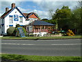
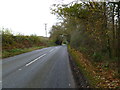
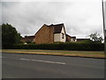
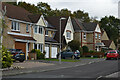
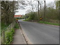
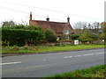
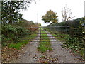
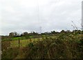
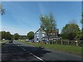
21 photos from this area
Area Information
Key information about the BH31 7LS including its size, population, and administrative classification.
- Area Type
- Postcode
- Area Size
- 1.8 hectares
- Population
- 1476
- Population Density
- 2972 people/km²
House Prices in BH31 7LS
44
Properties
£256,868
Average Sold Price
£56,950
Lowest Price
£510,000
Highest Price
Showing 44 properties
| Address | Type | Beds | Baths | Last Sale Price | Last Sale Date | |
|---|---|---|---|---|---|---|
| 81 Albion Way, Verwood, BH31 7LS | house | - | - | £295,000 | Mar 2025 | |
| 37 Albion Way, Verwood, BH31 7LS | house | 4 | 2 | £510,000 | Feb 2024 | |
| 71 Albion Way, Verwood, BH31 7LS | Terraced | 2 | - | £275,000 | Feb 2023 | |
| 83 Albion Way, Verwood, BH31 7LS | Detached | 2 | - | £299,950 | Jul 2022 | |
| 17 Albion Way, Verwood, BH31 7LS | Detached | 3 | - | £355,000 | Nov 2021 | |
| 75 Albion Way, Verwood, BH31 7LS | house | - | - | £257,500 | Sep 2021 | |
| 89 Albion Way, Verwood, BH31 7LS | Detached | 3 | 1 | £330,000 | Feb 2021 | |
| 53 Albion Way, Verwood, BH31 7LS | house | - | - | £485,000 | Sep 2020 | |
| 57 Albion Way, Verwood, BH31 7LS | house | - | - | £455,000 | Aug 2019 | |
| 3 Albion Way, Verwood, BH31 7LS | house | - | - | £318,500 | Jun 2019 |
Page 1 of 5
Energy Efficiency in BH31 7LS
Amenities
Schools
| Rank | School | Type | Entry gender | Ages |
|---|
Explore more schools in this area
Go to Schools tabDemographics
Household Size
Two person
most common
Accommodation Type
Houses
most common
Tenure
90
majority
Ethnic Group
White
most common
Religion
N/A
most common
Household Composition
N/A
most common
Age
47
median
Adults (30-64 years)
most common
Household Deprivation
N/A
with no deprivation
NS-SEC
41
in Lower managerial occupations
Explore more demographic insights in this area
Go to Demographics tabPlanning
Planning Constraints
- Flood RiskPremium
- Ramsar Wetland SitesPremium
- Area of Outstanding Natural BeautyPremium
- Protected Nature ReservePremium
- Protected WoodlandPremium