Area Overview for BH31 7AA
Photos of BH31 7AA

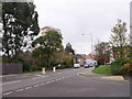


57 photos from this area
Area Information
Key information about the BH31 7AA including its size, population, and administrative classification.
- Area Type
- Postcode
- Area Size
- 3.4 hectares
- Population
- 1452
- Population Density
- 737 people/km²
House Prices in BH31 7AA
25
Properties
£369,667
Average Sold Price
£117,000
Lowest Price
£625,000
Highest Price
Showing 25 properties
| Address | Type | Beds | Baths | Last Sale Price | Last Sale Date | |
|---|---|---|---|---|---|---|
| 25A Ringwood Road, Verwood, BH31 7AA | Bungalow | - | - | £515,000 | Aug 2023 | |
| 33 Ringwood Road, Verwood, BH31 7AA | Chalet | 4 | - | £625,000 | Jul 2022 | |
| 19 Ringwood Road, Verwood, BH31 7AA | Detached | 4 | 1 | £425,000 | Apr 2021 | |
| 21 Ringwood Road, Verwood, BH31 7AA | Detached | 2 | 1 | £366,500 | Sep 2018 | |
| 27A Ringwood Road, Verwood, BH31 7AA | Bungalow | - | - | £365,000 | Feb 2017 | |
| 29 Ringwood Road, Verwood, BH31 7AA | Bungalow | - | - | £332,500 | Feb 2013 | |
| 23 Ringwood Road, Verwood, BH31 7AA | Bungalow | 4 | - | £450,000 | Dec 2012 | |
| 31 Ringwood Road, Verwood, BH31 7AA | Bungalow | - | - | £131,000 | Feb 1998 | |
| 27 Ringwood Road, Verwood, BH31 7AA | Detached | - | - | £117,000 | Jun 1995 | |
| Flat 14, Restynge House, 11-13 Ringwood Road, Verwood, BH31 7AA | Flat | 2 | 1 | - | - |
Page 1 of 3
Energy Efficiency in BH31 7AA
Amenities
Schools
| Rank | School | Type | Entry gender | Ages |
|---|
Explore more schools in this area
Go to Schools tabDemographics
Household Size
Family (3-5 people)
most common
Accommodation Type
Houses
most common
Tenure
85
majority
Ethnic Group
White
most common
Religion
N/A
most common
Household Composition
N/A
most common
Age
47
median
Adults (30-64 years)
most common
Household Deprivation
N/A
with no deprivation
NS-SEC
44
in Lower managerial occupations
Explore more demographic insights in this area
Go to Demographics tabPlanning
Planning Constraints
- Flood RiskPremium
- Ramsar Wetland SitesPremium
- Area of Outstanding Natural BeautyPremium
- Protected Nature ReservePremium
- Protected WoodlandPremium