Area Overview for BH31 6GE
Photos of BH31 6GE
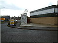
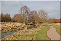
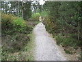
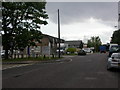
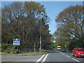
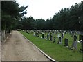
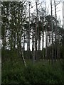
13 photos from this area
Area Information
Key information about the BH31 6GE including its size, population, and administrative classification.
- Area Type
- Postcode
- Area Size
- 4.2 hectares
- Population
- Not available
- Population Density
- Not available
House Prices in BH31 6GE
51
Properties
£263,399
Average Sold Price
£100,000
Lowest Price
£465,000
Highest Price
Showing 51 properties
| Address | Type | Beds | Baths | Last Sale Price | Last Sale Date | |
|---|---|---|---|---|---|---|
| 62 Kiln Way, Verwood, BH31 6GE | Terraced | 2 | 1 | £280,000 | Mar 2025 | |
| 35 Kiln Way, Verwood, BH31 6GE | Terraced | 4 | 3 | £390,000 | Feb 2025 | |
| 7 Kiln Way, Verwood, BH31 6GE | Terraced | 3 | 1 | £335,000 | Jun 2024 | |
| 15 Kiln Way, Verwood, BH31 6GE | Terraced | 2 | 1 | £290,000 | May 2024 | |
| 33 Kiln Way, Verwood, BH31 6GE | Semi-detached | 4 | 2 | £410,000 | May 2023 | |
| 27 Kiln Way, Verwood, BH31 6GE | Terraced | 2 | 1 | £270,000 | Feb 2023 | |
| 36 Kiln Way, Verwood, BH31 6GE | Terraced | 2 | 1 | £290,000 | Oct 2022 | |
| 60 Kiln Way, Verwood, BH31 6GE | house | - | - | £287,000 | Aug 2022 | |
| 19 Kiln Way, Verwood, BH31 6GE | Terraced | 3 | 1 | £295,000 | Jan 2022 | |
| 14 Kiln Way, Verwood, BH31 6GE | Detached | 3 | 2 | £380,000 | Sep 2021 |
Page 1 of 6
Energy Efficiency in BH31 6GE
Amenities
Schools
| Rank | School | Type | Entry gender | Ages |
|---|
Explore more schools in this area
Go to Schools tabDemographics
Household Size
Two person
most common
Accommodation Type
Houses
most common
Tenure
88
majority
Ethnic Group
White
most common
Religion
N/A
most common
Household Composition
N/A
most common
Age
47
median
Adults (30-64 years)
most common
Household Deprivation
N/A
with no deprivation
NS-SEC
42
in Lower managerial occupations
Explore more demographic insights in this area
Go to Demographics tabPlanning
Planning Constraints
- Flood RiskPremium
- Ramsar Wetland SitesPremium
- Area of Outstanding Natural BeautyPremium
- Protected Nature ReservePremium
- Protected WoodlandPremium