Area Overview for BH31 6FA
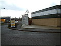
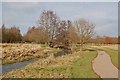
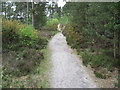
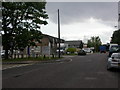
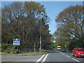
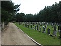
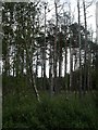
Photos of BH31 6FA
Area Information
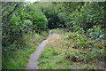
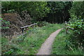
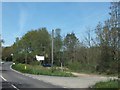
BH31 6FA is a small residential postcode in eastern Dorset, England, encompassing part of the town of Verwood. Situated near the Hampshire border, it lies approximately 5 miles from Ringwood, 10 miles from Bournemouth, and 13 miles from Poole. The area is defined by its compact size and low population of 2,034, reflecting a quiet, close-knit community. Historically, Verwood was a heathland settlement with ties to pottery and brick-making industries, though today it has evolved into a growing town with modern infrastructure. The postcode area includes a mix of residential properties, with no major industrial activity. Its proximity to the River Crane and surrounding heathland offers a blend of natural and built environments. Residents benefit from nearby amenities such as supermarkets, including The Southern Co-operative, Lidl Verwood, and Morrisons Verwood, as well as access to Bournemouth Airport. The area’s character is shaped by its historical roots and recent development, making it a place where tradition meets contemporary living.
- Area Type
- Postcode
- Area Size
- Not available
- Population
- Not available
- Population Density
- Not available
BH31 6FA is primarily an owner-occupied area, with 88% of homes owned by residents rather than rented. The accommodation type is predominantly houses, which is unusual for a small postcode area but may reflect the town’s historical development as a cluster of single-family homes. This suggests a market skewed towards buyers seeking private, spacious properties rather than apartments or shared housing. The high home ownership rate indicates stability, with limited pressure from rental demand. However, the small size of the area means buyers should consider nearby suburbs for more housing options. The focus on houses may appeal to those prioritising privacy and space, though it also implies a niche market with fewer properties available. Prospective buyers should note the area’s compact nature and assess whether the existing stock meets their specific needs.
House Prices in BH31 6FA
No properties found in this postcode.
Energy Efficiency in BH31 6FA
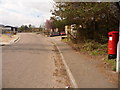
Living in BH31 6FA provides access to a range of local amenities within practical reach. The area includes five retail outlets, such as The Southern Co-operative, Lidl Verwood, and Morrisons Verwood, ensuring daily shopping needs are met. These stores offer a mix of essentials and convenience, supporting a self-sufficient lifestyle. The nearby Bournemouth Airport adds to the area’s connectivity, though it is not clear how frequently it is used by residents. Verwood’s historical character, including heathland Sites of Special Scientific Interest and landmarks like Stephen’s Castle, adds a unique cultural dimension. The absence of an upper school, however, may require families to look to nearby towns for secondary education. Overall, the area balances modern convenience with historical charm, offering a quiet but functional environment for daily life.
Amenities
Schools
| Rank | School | Type | Entry gender | Ages |
|---|
Explore more schools in this area
Go to Schools tabDemographics
The population of BH31 6FA is 2,034, with a median age of 47, indicating a predominantly adult population. The most common age range is 30–64 years, suggesting a community focused on middle-aged families and professionals. Home ownership is high, at 88%, with houses being the primary accommodation type. This reflects a stable, long-term resident base rather than a transient rental market. The predominant ethnic group is White, aligning with broader demographic trends in the region. The area’s age profile and ownership rates suggest a mature, settled community with limited youth or elderly populations. While no specific deprivation data is provided, the high home ownership and low population density imply a relatively affluent, low-pressure environment. This demographic structure may appeal to buyers seeking a quiet, family-oriented neighbourhood with minimal turnover.
Household Size
Accommodation Type
Tenure
Ethnic Group
Religion
Household Composition
Age
Household Deprivation
NS-SEC
Explore more demographic insights in this area
Go to Demographics tabPlanning
Planning Constraints
- Flood RiskPremium
- Ramsar Wetland SitesPremium
- Area of Outstanding Natural BeautyPremium
- Protected Nature ReservePremium
- Protected WoodlandPremium
- Crime RiskPremium