Area Overview for BH31 6AU
Photos of BH31 6AU


Area Information
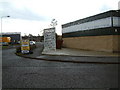
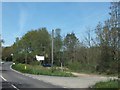
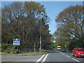
BH31 6AU lies in the small town of Verwood, Dorset, a quiet residential cluster near the Hampshire border. With a population of just over 2,000, it is a tight-knit community where daily life is shaped by its proximity to the River Crane and surrounding heathland. The area has grown steadily since the 20th century, evolving from a scattered heathland settlement into a town of around 15,000 residents, though the postcode itself remains a small, focused cluster. Verwood’s history is tied to pottery, brick-making, and heathland trades, with landmarks like Stephen’s Castle and the Verwood Memorial Hall adding local character. Residents benefit from proximity to Bournemouth, just 10 miles away, offering access to a larger urban hub without the density. The area’s low crime risk and minimal environmental constraints make it appealing for families and retirees alike. Living here means a balance of rural tranquillity and practical connectivity, with nearby amenities and transport links ensuring convenience without sacrificing the charm of a smaller town.
- Area Type
- Postcode
- Area Size
- Not available
- Population
- Not available
- Population Density
- Not available
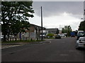
BH31 6AU is predominantly an owner-occupied area, with 88% of homes owned by residents rather than rented. The accommodation type is largely houses, which is uncommon for small postcode areas and suggests a focus on single-family homes. This contrasts with urban centres where flats and apartments dominate, and it may reflect Verwood’s historical development as a settlement for tradespeople and families requiring larger living spaces. The high home ownership rate indicates a stable market with limited turnover, which could benefit buyers seeking long-term investment. However, the small size of the postcode means the housing stock is limited, and buyers may need to look beyond BH31 6AU for more options. The area’s proximity to Bournemouth and Poole could also influence property values, with commuters potentially viewing it as a quieter alternative to larger towns.
House Prices in BH31 6AU
No properties found in this postcode.
Energy Efficiency in BH31 6AU
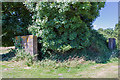
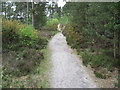
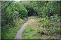
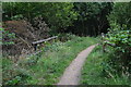
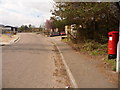
Living in BH31 6AU provides access to a range of practical amenities within reach. The retail sector includes stores like Lidl Verwood, Morrisons Verwood, and The Southern Co-operative Co, offering everyday shopping needs. For leisure, the nearby heathland—designated as Sites of Special Scientific Interest—provides walking and cycling opportunities, though no specific parks are named in the data. The Verwood Memorial Hall, opened in 1959, hosts community events, adding to the town’s social fabric. Bournemouth Airport is a short drive away, facilitating travel. The area’s character is defined by its historical roots and low-density development, creating a relaxed lifestyle. While there is no mention of dining venues or cafes, the presence of major supermarkets suggests a focus on convenience over fine dining. The mix of retail, green space, and transport links supports a balanced daily life.
Amenities
Schools
| Rank | School | Type | Entry gender | Ages |
|---|
Explore more schools in this area
Go to Schools tabDemographics
The population of BH31 6AU is 2,034, with a median age of 47, indicating a mature demographic skewed toward adults aged 30–64. Home ownership is exceptionally high at 88%, suggesting a stable, long-term resident base. The predominant accommodation type is houses, reflecting a preference for single-family living rather than flats or apartments. The predominant ethnic group is White, though no specific diversity metrics are provided. The age profile implies a community with established careers and families, potentially with fewer young children or retirees compared to other areas. This demographic mix may influence local services, with amenities catering to middle-aged adults rather than younger or older populations. The absence of data on deprivation or income levels means the quality of life cannot be fully assessed, but the high home ownership and low crime risk suggest a relatively affluent and secure environment.
Household Size
Accommodation Type
Tenure
Ethnic Group
Religion
Household Composition
Age
Household Deprivation
NS-SEC
Explore more demographic insights in this area
Go to Demographics tabPlanning
Planning Constraints
- Flood RiskPremium
- Ramsar Wetland SitesPremium
- Area of Outstanding Natural BeautyPremium
- Protected Nature ReservePremium
- Protected WoodlandPremium