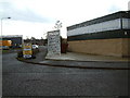
Area Overview for BH31 6AT
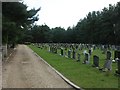
Photos of BH31 6AT


Area Information
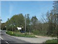
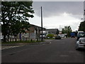
Living in BH31 6AT, a small residential cluster in eastern Dorset, means inhabiting a densely populated area of 7,073 square metres with 2,034 residents. This postcode sits on the Hampshire border, near the River Crane, which flows into the Moors River. The area’s compact size and high population density—287,568 people per square kilometre—suggest a tightly knit community, though the town of Verwood, which includes this postcode, has grown significantly since the 20th century. Historically a heathland settlement, Verwood’s development has brought modern infrastructure, including schools and supermarkets, but it remains a town without an upper school. Daily life here balances historical roots with contemporary needs, from the cob church of 1829 to modern retail outlets. The area’s proximity to Ringwood, Bournemouth, and Poole offers easy access to larger towns, though local amenities are limited to what is immediately available. BH31 6AT’s character is shaped by its mix of residential clusters, small-scale retail, and the legacy of industries like pottery and brick-making that once defined the region.
- Area Type
- Postcode
- Area Size
- 7073 m²
- Population
- Not available
- Population Density
- Not available
The property market in BH31 6AT is characterised by high home ownership (88%) and a predominance of houses over flats or other accommodation types. This suggests a market skewed toward owner-occupied homes, likely attracting families or individuals seeking long-term stability. The small area size—7,073 square metres—means housing stock is limited, and the immediate surroundings may offer few alternatives for buyers. The absence of rental properties implies a lower turnover of homes, which could make the market competitive for first-time buyers or those seeking to move. Given the high population density and compact footprint, properties here are likely to be smaller, with proximity to local amenities such as Lidl, Morrisons, and The Southern Co-operative. For buyers, this area may appeal to those prioritising security of tenure and a quiet, established residential environment, though the limited housing supply could pose challenges for those needing more space or flexibility.
House Prices in BH31 6AT
Showing 1 properties
| Address | Type | Beds | Baths | Last Sale Price | Last Sale Date | |
|---|---|---|---|---|---|---|
| First Floor, 35 Black Moor Road, Verwood, BH31 6AT | Office | - | - | - | - |
Energy Efficiency in BH31 6AT
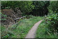
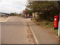
Residents of BH31 6AT have access to a modest but functional selection of amenities within practical reach. The nearby retail options include Lidl Verwood, Morrisons Verwood, and The Southern Co-operative Co, providing essential shopping and grocery needs. While the area lacks large supermarkets or specialised stores, these outlets serve the local population effectively. The town’s heathland landscape, including two Sites of Special Scientific Interest, offers natural spaces for walking or recreation, though no specific parks or leisure facilities are named in the data. The historical character of Verwood, with landmarks like Stephen’s Castle and the Verwood Memorial Hall, adds cultural value to daily life. However, the absence of an upper school and reliance on nearby towns for higher education may impact family-oriented planning. Overall, the lifestyle here balances rural tranquillity with the convenience of nearby retail and transport links, though amenities are limited to what is immediately available.
Amenities
Schools
| Rank | School | Type | Entry gender | Ages |
|---|
Explore more schools in this area
Go to Schools tabDemographics
The community in BH31 6AT is predominantly composed of adults aged 30–64, with a median age of 47. This suggests a stable, middle-aged population, likely focused on family life or long-term residence. Home ownership is high at 88%, indicating a strong preference for owning property over renting, which may reflect the area’s small size and limited housing stock. The accommodation type is primarily houses, rather than flats or apartments, aligning with the demographic profile of older, established households. The predominant ethnic group is White, though no further breakdown of diversity is provided. The high home ownership rate and age profile suggest a community with lower deprivation levels, as older adults and families are more likely to have long-term financial stability. However, the lack of an upper school and reliance on nearby towns for higher education may impact family planning for residents.
Household Size
Accommodation Type
Tenure
Ethnic Group
Religion
Household Composition
Age
Household Deprivation
NS-SEC
Explore more demographic insights in this area
Go to Demographics tabPlanning
Planning Constraints
- Flood RiskPremium
- Ramsar Wetland SitesPremium
- Area of Outstanding Natural BeautyPremium
- Protected Nature ReservePremium
- Protected WoodlandPremium