Area Overview for BH3 7LG
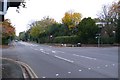
Photos of BH3 7LG

Area Information
Living in BH3 7LG places you within a specific residential cluster covering 2234 square metres in Bournemouth, Dorset. This small postcode area serves as a distinct local stronghold with a population of 1902 residents. While the area size appears diminutive compared to wider suburbs, the density creates an intimate community feel within the broader BH12 and Bournemouth backdrop. The location benefits from its position on the boundary between Bournemouth and Poole, integrating into the Talbot and Branksome Woods ward established by the Bournemouth, Christchurch and Poole council. Daily life for you in this postcodes involves navigating a suburban environment embedded with historic significance. The area encompasses part of Talbot Village, developed in the mid-19th century by the philanthropic Talbot sisters to provide housing and employment for local workers. You are surrounded by the legacy of St Mark's Church and the original almshouses that define the conservation area. Modern life here balances the quiet of wooded residential zones with the practical advantages of being near key transport hubs like Branksome and Pokesdown railway stations. The demographic profile skews towards adults aged 30 to 64, suggesting a community dominated by families and established residents rather than transient students or young professionals. With a median age of 47, the neighbourhood prioritises stability over high-energy nightlife. Residents here enjoy proximity to full transport networks including Bournemouth Airport and multiple ferry landings, making travel straightforward despite the compact nature of your immediate vicinity.
- Area Type
- Postcode
- Area Size
- 2234 m²
- Population
- Not available
- Population Density
- Not available
The property market in BH3 7LG is defined by a distinct split between ownership and rental, driven largely by the accommodation type within this specific postcode. With 45% home ownership, roughly half of the homes are owned outright or via mortgage, while the other half let to tenants. This 50-50 split suggests a healthy mix of blocks, though the data specifies that flats are the primary accommodation type for this area. Consequently, you are less likely to find detached houses or semi-detached properties directly within these BH3 coordinates compared to wider Talbot or Branksome Woods. For buyers seeking flats in BH3 7LG, the limited total area of 2234 square metres means supply is tightly controlled. You will compete with other investors and local buyers for available stock, as the scarcity of flats in such a small postcode cluster often drives demand up. The presence of Bournemouth University nearby influences the rental sector, potentially ensuring a steady demand for student or young professional tenants, which stabilises rental prices in flats. Given the historic inclusion of parts of Talbot Village and Charminster in the surrounding ward, prices in adjacent streets may vary significantly from those within the core BH3 7LG area. You might find the flats in here are more modest in size compared to listed cottages found in the conservation area nearby. An owner-occupier here would benefit from the stability of a ward that includes highmoor Farm and protected woodlands, adding community value to the property portfolio.
House Prices in BH3 7LG
Showing 9 properties
| Address | Type | Beds | Baths | Last Sale Price | Last Sale Date | |
|---|---|---|---|---|---|---|
| 7A Heron Court Road, Bournemouth, BH3 7LG | Flat | - | - | £150,000 | Mar 2005 | |
| Flat 3, 5 Heron Court Road, Bournemouth, BH3 7LG | Flat | 1 | 1 | - | - | |
| Flat 3, 3 Heron Court Road, Bournemouth, BH3 7LG | Flat | 1 | 1 | - | - | |
| Flat 4, 5 Heron Court Road, Bournemouth, BH3 7LG | Flat | - | - | - | - | |
| Flat 2, 5 Heron Court Road, Bournemouth, BH3 7LG | Flat | - | - | - | - | |
| 7 Heron Court Road, Bournemouth, BH3 7LG | Flat | - | - | - | - | |
| Flat 1, 3 Heron Court Road, Bournemouth, BH3 7LG | Flat | - | - | - | - | |
| Flat 2, 3 Heron Court Road, Bournemouth, BH3 7LG | Flat | - | - | - | - | |
| Flat 1, 5 Heron Court Road, Bournemouth, BH3 7LG | Flat | - | - | - | - |
Energy Efficiency in BH3 7LG
Your lifestyle in BH3 7LG is defined by strong links to major retail and leisure hubs within Bournemouth and Poole. You have access to notably large supermarkets including Tesco Bournemouth, Co-op Charminster, and Asda Charminster, ensuring your weekly grocery shopping requires little travel. These retail giants are practical necessities for daily life, bringing bulk shopping and varied product ranges directly to your doorstep. For leisure and socializing, you are surrounded by five railway stations including Branksome and Pokesdown, which serve as community gathering points and transport gateways. The area also benefits from proximity to Bournemouth International Airport, which often hosts events and visitor activities beyond just flights. Furthermore, the presence of five ferry landing sites like Tuckton Tea Gardens adds a unique coastal dimension; these hubs often serve local events and provide scenic routes across the water. You can exercise daily in nearby Albion Woods plantation, a notable feature of the local landscape that supports active living and mental well-being. Highmoor Farm, which remains operational nearby, offers green space opportunities for families and walkers. The conservation area status of Talbot Village means you walk past historic architecture and mature trees, creating a peaceful environment for evening strolls. Dining and social options are plentiful in the immediate vicinity, supported by the high concentration of amenities that serve the 1902 local population.
Amenities
Schools
Families considering BH3 7LG are well positioned regarding educational options. The area boasts St Martin's School, a nearby independent institution holding a 'good' Ofsted rating. This school offers inclusive education for pupils who may not require medical education or standard mainstream schooling, providing a vital support network for special needs within the community. While St Martin's is the only school explicitly listed for this postcode, the broader ward places you near St Mark's Church of England Primary. That school serves approximately 460 pupils and contributes to the local educational landscape, ensuring a multi-faceted approach to learning for children in the BN12 and surrounding postcodes. The mix of independent and church-affiliated schools indicates a diverse educational provision where parents have varied choices depending on their religious or pedagogical preferences. Living in BH3 7LG means sending children to a school system that balances special needs support with comprehensive primary education. You do not need to travel extensively for schooling as St Martin's is situated within the immediate vicinity. The presence of a quality rated independent school adds a layer of educational excellence to the residential profile, attracting families who value small class sizes and alternative curriculum formats.
| Rank | School | Type | Entry gender | Ages |
|---|
Explore more schools in this area
Go to Schools tabDemographics
The community in BH3 7LG reflects a mature and established demographic profile. Data shows a median age of 47 years, confirming that adults between 30 and 64 years constitute the most common age range. This indicates a neighbourhood anchored by long-term residents who have settled in for the duration. Only 45% of the population owns their homes, meaning nearly 55% of the 1902 residents are renters or sharing accommodation. Consequently, tenancy turnover may be more prevalent than in owner-occupied zones, influencing the local social fabric. Accommodation types are predominantly flats, a direct result of the postcodes focusing on residential clusters rather than traditional detached suburban estates. This contrasts with older Victorian era housing found nearby in Talbot Village, where the architectural heritage remains largely intact. The predominant ethnic group identified is White, which aligns with the historic demographic of the Dorset coast and the original development of the area in the 1850s. Residents should expect a quieter social environment typical of areas with older residents and fewer young families raising toddlers. The high proportion of flats supports a lifestyle focused on urban convenience rather than large garden spaces. You are part of a ward that supports residents' associations, indicating a thriving local governance model where neighbours participate actively in community decisions. The density of 851,221 people per square kilometre is calculated based on the small total area size, highlighting how concentrated the population is within these specific BH3 boundaries.
Household Size
Accommodation Type
Tenure
Ethnic Group
Religion
Household Composition
Age
Household Deprivation
NS-SEC
Explore more demographic insights in this area
Go to Demographics tabPlanning
Planning Constraints
- Flood RiskPremium
- Ramsar Wetland SitesPremium
- Area of Outstanding Natural BeautyPremium
- Protected Nature ReservePremium
- Protected WoodlandPremium