Area Overview for BH24 2AN
Photos of BH24 2AN

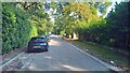
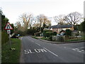
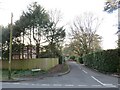
43 photos from this area
Area Information
Key information about the BH24 2AN including its size, population, and administrative classification.
- Area Type
- Postcode
- Area Size
- 8.6 hectares
- Population
- 1644
- Population Density
- 182 people/km²
House Prices in BH24 2AN
21
Properties
£772,143
Average Sold Price
£310,000
Lowest Price
£1,260,000
Highest Price
Showing 21 properties
| Address | Type | Beds | Baths | Last Sale Price | Last Sale Date | |
|---|---|---|---|---|---|---|
| Inglewood, The Chase, Ashley Heath, BH24 2AN | Detached | 5 | 3 | £950,000 | Jan 2025 | |
| Robina, The Chase, Ashley Heath, BH24 2AN | Detached | 5 | 4 | £1,260,000 | Oct 2023 | |
| San Juan, The Chase, Ashley Heath, BH24 2AN | Bungalow | - | - | £920,000 | Apr 2022 | |
| Avon Cottage, The Chase, Ashley Heath, BH24 2AN | Detached | 5 | - | £1,145,000 | Dec 2020 | |
| Upton Lodge, The Chase, Ashley Heath, BH24 2AN | house | - | - | £775,000 | Aug 2019 | |
| Avonbrook, The Chase, Ashley Heath, BH24 2AN | Bungalow | 4 | - | £775,000 | May 2019 | |
| Meadowside, The Chase, Ashley Heath, BH24 2AN | house | - | - | £875,000 | Apr 2019 | |
| Lonestar, The Chase, Ashley Heath, BH24 2AN | Detached | 5 | - | £1,005,000 | Nov 2015 | |
| Bryher, The Chase, Ashley Heath, BH24 2AN | Bungalow | 4 | - | £560,000 | Jun 2015 | |
| Kingfishers, The Chase, Ashley Heath, BH24 2AN | Bungalow | 3 | - | £620,000 | Sep 2013 |
Page 1 of 3
Energy Efficiency in BH24 2AN
Amenities
Schools
| Rank | School | Type | Entry gender | Ages |
|---|
Explore more schools in this area
Go to Schools tabDemographics
Household Size
Two person
most common
Accommodation Type
Houses
most common
Tenure
91
majority
Ethnic Group
White
most common
Religion
N/A
most common
Household Composition
N/A
most common
Age
47
median
Adults (30-64 years)
most common
Household Deprivation
N/A
with no deprivation
NS-SEC
46
in Lower managerial occupations
Explore more demographic insights in this area
Go to Demographics tabPlanning
Planning Constraints
- Flood RiskPremium
- Ramsar Wetland SitesPremium
- Area of Outstanding Natural BeautyPremium
- Protected Nature ReservePremium
- Protected WoodlandPremium