Area Overview for BH23 7ND
Photos of BH23 7ND
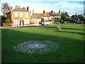
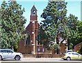
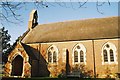
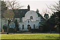
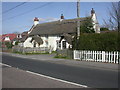
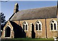
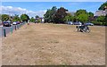
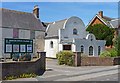
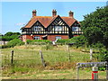
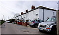
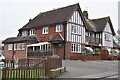
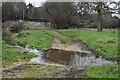
48 photos from this area
Area Information
Key information about the BH23 7ND including its size, population, and administrative classification.
- Area Type
- Postcode
- Area Size
- 5558 m²
- Population
- 1499
- Population Density
- 7189 people/km²
House Prices in BH23 7ND
15
Properties
£188,433
Average Sold Price
£99,950
Lowest Price
£261,500
Highest Price
Showing 15 properties
| Address | Type | Beds | Baths | Last Sale Price | Last Sale Date | |
|---|---|---|---|---|---|---|
| 25 Burnham Road, Christchurch, BH23 7ND | house | - | - | £242,000 | Dec 2016 | |
| 27 Burnham Road, Christchurch, BH23 7ND | house | 3 | - | £255,000 | May 2016 | |
| 29 Burnham Road, Christchurch, BH23 7ND | house | - | - | £261,500 | Jan 2016 | |
| 23 Burnham Road, Christchurch, BH23 7ND | Terraced | 2 | 2 | £233,950 | Apr 2014 | |
| 19 Burnham Road, Christchurch, BH23 7ND | Terraced | 3 | 1 | £223,000 | Oct 2007 | |
| 26 Burnham Road, Christchurch, BH23 7ND | Terraced | - | - | £140,000 | Aug 2007 | |
| 22 Burnham Road, Christchurch, BH23 7ND | Terraced | - | - | £132,500 | Jul 2002 | |
| 17 Burnham Road, Christchurch, BH23 7ND | Terraced | - | - | £108,000 | Nov 2000 | |
| 32 Burnham Road, Christchurch, BH23 7ND | Land | - | - | £99,950 | Nov 1999 | |
| 20 Burnham Road, Christchurch, BH23 7ND | Detached | 3 | 1 | - | - |
Page 1 of 2
Energy Efficiency in BH23 7ND
Amenities
Schools
| Rank | School | Type | Entry gender | Ages |
|---|
Explore more schools in this area
Go to Schools tabDemographics
Household Size
Family (3-5 people)
most common
Accommodation Type
Houses
most common
Tenure
78
majority
Ethnic Group
White
most common
Religion
N/A
most common
Household Composition
N/A
most common
Age
47
median
Adults (30-64 years)
most common
Household Deprivation
N/A
with no deprivation
NS-SEC
30
in Lower managerial occupations
Explore more demographic insights in this area
Go to Demographics tabPlanning
Planning Constraints
- Flood RiskPremium
- Ramsar Wetland SitesPremium
- Area of Outstanding Natural BeautyPremium
- Protected Nature ReservePremium
- Protected WoodlandPremium