Area Overview for BH23 2TD
Photos of BH23 2TD
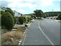
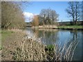
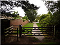
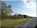
31 photos from this area
Area Information
Key information about the BH23 2TD including its size, population, and administrative classification.
- Area Type
- Postcode
- Area Size
- 5508 m²
- Population
- 1876
- Population Density
- 74 people/km²
House Prices in BH23 2TD
7
Properties
£324,417
Average Sold Price
£137,500
Lowest Price
£450,000
Highest Price
Showing 7 properties
| Address | Type | Beds | Baths | Last Sale Price | Last Sale Date | |
|---|---|---|---|---|---|---|
| 94 Hillside Drive, Christchurch, BH23 2TD | Land | - | - | £450,000 | May 2018 | |
| 86 Hillside Drive, Christchurch, BH23 2TD | Bungalow | - | - | £370,000 | Sep 2015 | |
| 84 Hillside Drive, Christchurch, BH23 2TD | Bungalow | - | - | £365,000 | Apr 2015 | |
| 88 Hillside Drive, Christchurch, BH23 2TD | Bungalow | 3 | 1 | £359,000 | Feb 2015 | |
| 82 Hillside Drive, Christchurch, BH23 2TD | Bungalow | - | - | £265,000 | Mar 2004 | |
| 90 Hillside Drive, Christchurch, BH23 2TD | Detached | - | - | £137,500 | Jul 1998 | |
| 92 Hillside Drive, Christchurch, BH23 2TD | Bungalow | - | - | - | - |
Energy Efficiency in BH23 2TD
Amenities
Schools
| Rank | School | Type | Entry gender | Ages |
|---|
Explore more schools in this area
Go to Schools tabDemographics
Household Size
Two person
most common
Accommodation Type
Houses
most common
Tenure
80
majority
Ethnic Group
White
most common
Religion
N/A
most common
Household Composition
N/A
most common
Age
47
median
Adults (30-64 years)
most common
Household Deprivation
N/A
with no deprivation
NS-SEC
38
in Lower managerial occupations
Explore more demographic insights in this area
Go to Demographics tabPlanning
Planning Constraints
- Flood RiskPremium
- Ramsar Wetland SitesPremium
- Area of Outstanding Natural BeautyPremium
- Protected Nature ReservePremium
- Protected WoodlandPremium