Area Overview for BH22 9NR
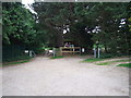
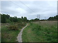
Photos of BH22 9NR


Area Information
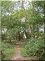
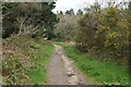
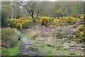
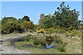
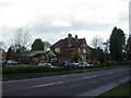
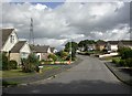
Living in BH22 9NR places you within a specific residential cluster in the town of Ferndown, Dorset. This precise postcode covers an area of 1,150 square metres and is home to a population of 1,130 people. You are situated in a location that balances suburban convenience with proximity to larger urban centres north of Bournemouth. The area falls under the civil parish of Ferndown, which historically includes communities such as Ameysford, Hampreston, and Longham. This location offers a blend of semi-rural living and accessible town facilities. The demographic profile indicates a settled community where adults between 30 and 64 years dominate the age range. Daily life here involves easy access to the Penny's Walk shopping centre, local leisure facilities, and the historic Ampfield and Ferndown Country Park. You will find that the neighbourhood has grown from ancient settlements mentioned in the Domesday Book into a modern residential hub. The area is characterised by housing estates and preserved woodlands, including Holt Heath and Ferndown Common. While the specific locality represents a small slice of the wider parish, it benefits from being a secure, owner-occupied community. Residents enjoy a low density of 189 people per square kilometre, providing a quiet atmosphere while remaining close to the economic heartlands of East Dorset.
- Area Type
- Postcode
- Area Size
- 1150 m²
- Population
- 1130
- Population Density
- 189 people/km²
The property market in BH22 9NR is driven by owner-occupiers rather than investors or short-term renters. With a home ownership rate of 87%, the vast majority of properties in this postcode are privately purchased. This high level of ownership creates a stable market where residents have a long-term stake in their properties. The accommodation type is strictly houses, meaning you will not find apartments or studio flats within this specific 1,150 square metre area. Prospective buyers looking at homes in BH22 9NR are entering an established market of residential estates and semi-rural properties. This concentration of houses suits buyers seeking traditional domestic spaces with gardens. The lack of rental stock limits competition for tenants but stabilises prices for those purchasing. Your neighbours are likely to have owned their homes for an extended period, fostering a community where property values are maintained through long-term care. When searching for homes in BH22 9NR, you should expect properties to vary in size and age, reflecting the area's evolution from agricultural land to modern suburban clusters. The market here does not suffer from the volatility often seen in high-density rental districts. Instead, it offers a reliable avenue for those requiring a permanent family home.
House Prices in BH22 9NR
Showing 1 properties
| Address | Type | Beds | Baths | Last Sale Price | Last Sale Date | |
|---|---|---|---|---|---|---|
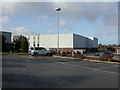
| A Polden And Sons Ltd, 393 Wimborne Road East, Ferndown, BH22 9NR | Industrial | - | - | - | - |
Energy Efficiency in BH22 9NR
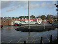
Daily life in BH22 9NR is supported by a robust network of local amenities. You have immediate access to five retail locations, including specific outlets such as Tesco Ferndown, M&S Ferndown, and Iceland Ferndown. These shops provide all essentials without the need for a long drive into Bournemouth. Leisure pursuits are facilitated by the Ferndown Community Centre, which houses the Barrington Theatre, and a local sports centre featuring a pool and squash courts. These venues offer cultural and physical opportunities right in your immediate neighbourhood. For transport beyond the local area, two airports serve the region: Bournemouth Airport and Bournemouth International Airport. If you require train travel, Branksome Railway Station is the closest option, with Bournemouth and Parkstone stations also nearby. The area maintains a strong connection to retail and leisure without the noise of a dense urban centre. You will find that the Penny's Walk shopping centre acts as a central hub for the community, offering supermarkets and libraries under one roof. This layout means you can conduct daily household tasks efficiently while retaining access to the wider county for weekend excursions to the Old Course or the New Forest.
Amenities
Schools
Families living near BH22 9NR benefit from access to several educational institutions. The nearest primary education options include Ferndown First School, Ferndown Upper School, and Ferndown Middle School. Ferndown Upper School holds an Ofsted rating of good, providing reassurance for parents selecting their child's local education. The school list also includes an academy version of Ferndown First School and an academy version of Ferndown Middle School, offering alternative educational structures within the immediate vicinity. This mix of school types means you have multiple options for your children's secondary education needs in the broader Ferndown area. The presence of both maintained schools and academies ensures a diverse educational offer close to home. While the specific data does not distinguish between the two academies, both replace the original schools in the list, suggesting a modernised curriculum framework. For buyers considering schools near BH22 9NR, the proximity of these institutions is a key asset. You do not need to travel far to find a classroom for your child. The concentration of schools within the town limits ensures that daily commutes to education are short and manageable for working parents.
| Rank | School | Type | Entry gender | Ages |
|---|
Explore more schools in this area
Go to Schools tabDemographics
The community residing in BH22 9NR is defined by stability and age. The median age stands at 47 years, reflecting a mature population where adults aged between 30 and 64 constitute the most common age group. This demographic shift suggests a neighbourhood favoured by families and empty nesters rather than young professionals entering the property market for the first time. Home ownership rates are significantly high, reaching 87%. This indicates that the vast majority of residents have purchased their homes, contributing to a long-term community feel and lower rental turnover. Accommodation in this postcode is almost exclusively composed of houses. There are no flats or purpose-built high-density blocks within this specific cluster. The predominant ethnic group is White, aligning with the broader demographic patterns of rural Dorset. The low population density of 189 people per square kilometre reinforces the residential nature of the estate. You will not encounter the transient populations often found in commercial hubs or major student cities. Instead, the 1,130 residents live in a setting where neighbours are likely to stay for decades. This stability correlates with a safe environment, as the area consistently records low crime rates compared to national averages. The settlement pattern reflects a traditional British suburb designed for permanent families rather than flexible urban living.
Household Size
Accommodation Type
Tenure
Ethnic Group
Religion
Household Composition
Age
Household Deprivation
NS-SEC
Explore more demographic insights in this area
Go to Demographics tabPlanning
Planning Constraints
- Flood RiskPremium
- Ramsar Wetland SitesPremium
- Area of Outstanding Natural BeautyPremium
- Protected Nature ReservePremium
- Protected WoodlandPremium