Area Overview for BH22 0WA
Photos of BH22 0WA
Area Information
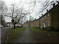
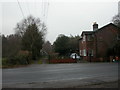
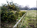
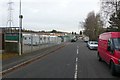
BH22 0WA is a small residential postcode in Dorset, England, situated on the northern edge of the Poole-Bournemouth conurbation. With a population of 1,315 and a density of 332 people per square kilometre, it reflects a tight-knit, commuter-focused community. The area is part of West Moors, a village with a history rooted in railway development and wartime infrastructure. Residents benefit from proximity to Bournemouth, just 10 miles away, and access to natural landscapes such as the Jurassic Coast, Purbeck Hills, and New Forest National Park. The village retains echoes of its past, including the original railway level crossing gatekeeper’s cottage and the Castleman Trailway, a footpath repurposed from the old trackbed. Daily life here is defined by suburban convenience, with a modest village centre offering essential services. The area’s appeal lies in its balance of quiet residential living and easy access to larger urban hubs, making it ideal for those seeking a base for commuting to nearby cities while enjoying a connection to rural England’s scenic backdrops.
- Area Type
- Postcode
- Area Size
- Not available
- Population
- 1315
- Population Density
- 332 people/km²
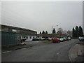
BH22 0WA is primarily an owner-occupied area, with 80% of homes owned by residents rather than rented. The accommodation type is predominantly houses, which is typical of suburban settings and suggests a focus on family homes with private gardens and space. This contrasts with areas dominated by flats or rental properties, where turnover is higher. The small postcode area and limited housing stock mean the market is likely tight, with properties holding value due to their scarcity. Buyers should consider the area’s role as a commuter hub, with proximity to Bournemouth and other cities, which may influence property prices. The predominance of houses also implies that the area is less suited to investors seeking high-yield rental properties. For those prioritising stability and long-term ownership, BH22 0WA offers a low-risk, family-oriented environment.
House Prices in BH22 0WA
No properties found in this postcode.
Energy Efficiency in BH22 0WA
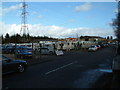
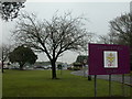
The lifestyle in BH22 0WA is shaped by its proximity to essential amenities and natural spaces. Within practical reach are five retail outlets, including Spar, Tesco West, and Morrisons Daily, offering everyday shopping needs. The area’s connection to Bournemouth and Poole provides access to larger retail and dining options, though the village itself retains a modest commercial centre. Recreational opportunities include the Castleman Trailway, a former railway path ideal for walking or cycling. The surrounding landscapes—Jurassic Coast, Purbeck Hills, and New Forest—offer scenic outdoor activities. The combination of local shops, easy travel to major cities, and access to natural beauty creates a balanced lifestyle, blending suburban convenience with rural tranquillity.
Amenities
Schools
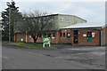
The nearest schools to BH22 0WA include West Moors, St Mary’s Church of England Voluntary Controlled First School, a primary school, and St Mary’s CofE First School & Nursery, which is an academy. Both institutions serve the local community, providing education for younger children. The presence of a primary school and an academy suggests a range of educational options, though no secondary schools are listed in the data. Families with young children may find the proximity to these schools convenient, reducing the need for long commutes. However, the absence of secondary education options in the immediate area could necessitate travel to nearby towns like Bournemouth or Poole for older students. The mix of school types reflects a blend of traditional state education and academy-led provision, which may offer varying teaching approaches and resources.
| Rank | School | Type | Entry gender | Ages |
|---|
Explore more schools in this area
Go to Schools tabDemographics
The population of BH22 0WA has a median age of 47, with the majority of residents aged 30–64. This suggests a mature, stable community with a strong presence of middle-aged adults. Home ownership is high at 80%, indicating a preference for long-term residency over rental properties. The accommodation type is predominantly houses, reflecting a suburban character rather than high-density housing. The predominant ethnic group is White, though no specific data on diversity or deprivation levels is provided. The age profile and ownership figures suggest a community focused on family living and established careers, with limited presence of younger or older demographics. The absence of data on deprivation means the area’s socioeconomic challenges cannot be assessed, but the high home ownership rate and median age imply a relatively secure, middle-income environment.
Household Size
Accommodation Type
Tenure
Ethnic Group
Religion
Household Composition
Age
Household Deprivation
NS-SEC
Explore more demographic insights in this area
Go to Demographics tabPlanning
Planning Constraints
- Flood RiskPremium
- Ramsar Wetland SitesPremium
- Area of Outstanding Natural BeautyPremium
- Protected Nature ReservePremium
- Protected WoodlandPremium