Area Overview for BH22 0PW
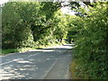
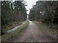
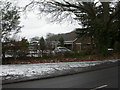
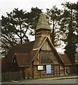
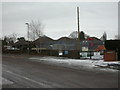
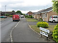
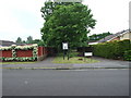
Photos of BH22 0PW

Area Information
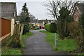
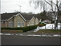
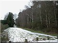
Living in BH22 0PW, part of the village of West Moors in Dorset, means residing in a small, residential cluster with a population of 1,453. Nestled 10 miles from Bournemouth and near the Poole-Bournemouth conurbation, this area blends suburban tranquility with proximity to major cities. West Moors has grown steadily since the 19th century, driven by commuters to Bournemouth, Poole, and London. The village retains historical traces of its railway past, including the Castleman Trailway footpath, which runs along the former trackbed. Residents benefit from access to natural landscapes like the Jurassic Coast and Purbeck Hills, yet the area functions primarily as a commuter hub. The commercial village centre offers essential services, while the parish church of St Mary the Virgin stands as a notable landmark. With a population skewed toward older residents, BH22 0PW is a quiet, established community where daily life revolves around local amenities and the convenience of nearby urban centres.
- Area Type
- Postcode
- Area Size
- Not available
- Population
- 1453
- Population Density
- 3110 people/km²
The property market in BH22 0PW is dominated by owner-occupied homes, with 90% of properties in private hands. The accommodation type is predominantly houses, reflecting the area’s suburban character. This suggests a limited rental market, with most properties serving long-term residents rather than transient tenants. As a small residential cluster, the housing stock is likely to be established, with older properties forming the majority. Buyers should consider the area’s proximity to Bournemouth and Poole, which may influence property values and desirability for commuters. The high home ownership rate indicates strong community stability, but the small size of the postcode area means property options are limited. Those seeking investment or relocation should focus on the existing housing stock, which is likely to be family homes rather than newer developments. The lack of significant planning constraints or environmental restrictions further supports the appeal of BH22 0PW as a residential area.
House Prices in BH22 0PW
No properties found in this postcode.
Energy Efficiency in BH22 0PW
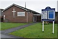
Residents of BH22 0PW have access to a modest but practical range of amenities within reach. The village centre includes five retail outlets, such as Tesco West, Spar, and Morrisons Daily, providing essential shopping options. Two major airports—Bournemouth Airport and Bournemouth International Airport—are nearby, enhancing travel convenience. The area’s character is defined by its role as a commuter settlement, with a village centre clustered around the station, school, and church. St Mary the Virgin parish church, built in 1896, is a focal point, while the Castleman Trailway offers recreational walking. The proximity to natural landscapes like the Jurassic Coast and Purbeck Hills adds to the appeal for outdoor enthusiasts. Though small, the area balances suburban comfort with access to larger urban amenities, making it suitable for those seeking a quieter lifestyle with easy access to cities.
Amenities
Schools
| Rank | School | Type | Entry gender | Ages |
|---|
Explore more schools in this area
Go to Schools tabDemographics
The population of BH22 0PW has a median age of 47, with the most common age range being elderly (65+ years). This suggests a community with a significant proportion of older residents, likely reflecting the area’s role as a retirement destination or long-term settlement. Home ownership is exceptionally high at 90%, indicating a stable, owner-occupied demographic. The predominant accommodation type is houses, which aligns with the residential character of the area. The predominant ethnic group is White, though specific diversity data is not provided. The high home ownership rate and elderly population profile suggest a community with low turnover and a focus on long-term residency. This demographic profile may influence local services and amenities, with a demand for healthcare and community-focused facilities. The area’s age profile also means a lower proportion of young families compared to other parts of the region.
Household Size
Accommodation Type
Tenure
Ethnic Group
Religion
Household Composition
Age
Household Deprivation
NS-SEC
Explore more demographic insights in this area
Go to Demographics tabPlanning
Planning Constraints
- Flood RiskPremium
- Ramsar Wetland SitesPremium
- Area of Outstanding Natural BeautyPremium
- Protected Nature ReservePremium
- Protected WoodlandPremium