Area Overview for BH22 0HU
Photos of BH22 0HU
Area Information
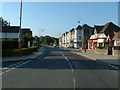
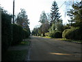
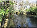
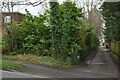
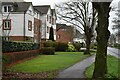
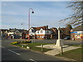
Living in BH22 0HU, part of the West Moors village in Dorset, means being part of a small, tightly knit residential community with a distinct character. The postcode covers a cluster of homes with a population of 1,621 people, packed into 1.23 km², creating a high population density of 1,327 people per square kilometre. Nestled on the northern edge of the Poole-Bournemouth conurbation, this area blends suburban comfort with proximity to natural beauty. Residents benefit from being within 10 miles of Bournemouth and 100 miles from London, making it a commuter hub for nearby cities. The village’s history as a railway junction from the 19th century still lingers, with remnants like the original level crossing gatekeeper’s cottage on Station Road. Today, BH22 0HU functions as a quiet residential enclave, where the pace of life is slower than in nearby urban centres, yet well-connected to major transport routes and amenities. The area’s charm lies in its balance of historical legacy and modern convenience, appealing to those seeking a stable, low-crime environment with access to regional services.
- Area Type
- Postcode
- Area Size
- Not available
- Population
- 1621
- Population Density
- 1327 people/km²
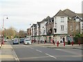
The property market in BH22 0HU is characterised by a high rate of home ownership, with 72% of properties owned by residents rather than rented. This suggests a stable, long-term market where properties are less likely to be available for short-term rental or speculative investment. The accommodation type is predominantly houses, which is typical of rural and semi-rural areas in England. This contrasts with urban centres where flats and apartments dominate. The small size of the postcode area means that the housing stock is limited, with few new developments likely to emerge. For buyers, this implies that properties in BH22 0HU are likely to be held by existing owners, with limited turnover. The focus on owner-occupied homes also suggests that the area is less attractive to young professionals or families seeking rental options, though proximity to Bournemouth and Poole may offer alternative housing choices nearby.
House Prices in BH22 0HU
No properties found in this postcode.
Energy Efficiency in BH22 0HU
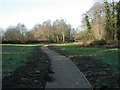
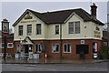
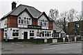
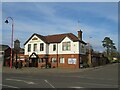
Residents of BH22 0HU have access to a range of nearby amenities, including five retail outlets such as Spar, Tesco West, and Morrisons Daily, ensuring convenience for daily shopping needs. The proximity to Bournemouth Airport and Bournemouth International Airport makes the area appealing for those requiring frequent travel. While the village itself is small, its location near the Poole-Bournemouth conurbation provides access to larger urban centres for dining, entertainment, and leisure. The surrounding landscape includes areas of outstanding natural beauty, such as the Jurassic Coast and Purbeck Hills, offering opportunities for outdoor activities. The village’s historical railway legacy is preserved through the Castleman Trailway, a footpath that allows residents to explore the former railway route. This blend of practical amenities, natural scenery, and historical features creates a lifestyle that balances suburban tranquillity with regional connectivity.
Amenities
Schools
| Rank | School | Type | Entry gender | Ages |
|---|
Explore more schools in this area
Go to Schools tabDemographics
The community in BH22 0HU is predominantly elderly, with a median age of 70 and the most common age range being 65+ years. This suggests a population that is largely retired or semi-retired, with 72% of homes owned outright by residents rather than rented. The accommodation type is primarily houses, reflecting a lack of high-density housing or flats in the area. The predominant ethnic group is White, which aligns with the broader demographic trends in rural Dorset. With such a high proportion of elderly residents, the area likely has a stable, low-turnover housing market, where properties are held long-term. The absence of significant deprivation data implies that residents may have higher disposable income, supporting the presence of home ownership and access to services. However, the age profile also means that healthcare and community support infrastructure are likely critical to maintaining quality of life for older residents.
Household Size
Accommodation Type
Tenure
Ethnic Group
Religion
Household Composition
Age
Household Deprivation
NS-SEC
Explore more demographic insights in this area
Go to Demographics tabPlanning
Planning Constraints
- Flood RiskPremium
- Ramsar Wetland SitesPremium
- Area of Outstanding Natural BeautyPremium
- Protected Nature ReservePremium
- Protected WoodlandPremium