Area Overview for BH21 8SS
Photos of BH21 8SS
Area Information
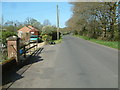
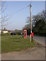
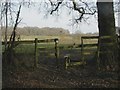
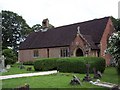
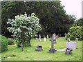
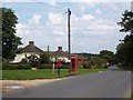
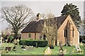
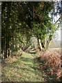
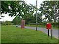
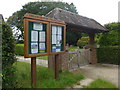
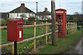
Living in BH21 8SS means being part of a small, tightly knit residential cluster in Dorset’s Woodlands village. With a population of 2,160 and a low density of 32 people per square kilometre, the area feels quiet and unspoiled. The village’s history stretches back to 1244, with its origins tied to local hamlets like Baggeridge and Knowlton. Modern residents benefit from proximity to nearby towns like Verwood, which offers retail and services. The Church of the Ascension, a Grade II listed building, stands as a historic anchor. Daily life here balances rural tranquillity with practical access to amenities. The area’s small size means a strong sense of community, though its limited scale means buyers should consider nearby neighbourhoods for broader options. For those seeking a peaceful, low-density lifestyle with historical roots, BH21 8SS offers a distinct alternative to busier urban areas.
- Area Type
- Postcode
- Area Size
- Not available
- Population
- 2160
- Population Density
- 32 people/km²
The property market in BH21 8SS is characterised by a 56% home ownership rate, indicating a modestly balanced mix of owner-occupied and rental properties. The accommodation type is primarily houses, suggesting a predominance of detached or semi-detached homes rather than apartments or flats. This aligns with the area’s low population density and rural or semi-rural setting. Given the small size of the postcode, the housing stock is limited, and buyers may need to consider nearby areas for more options. The focus on houses implies a market suited to families or those seeking space, though the lack of high-density housing may limit appeal for urban commuters. For buyers, this means a niche market with potential for stability, but limited scalability for larger property searches.
House Prices in BH21 8SS
No properties found in this postcode.
Energy Efficiency in BH21 8SS
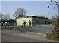
The lifestyle in BH21 8SS is shaped by its proximity to Verwood’s retail offerings, including Tesco Verwood, Morrisons Verwood, and Lidl Verwood. These stores provide access to groceries, household goods, and daily essentials, reducing the need for long commutes. The area’s low population density and rural character suggest limited dining or leisure options within the postcode itself, though nearby towns may offer more variety. The presence of the Church of the Ascension and historical sites adds cultural value, while the lack of detailed data on parks or recreational facilities means residents may need to travel for outdoor activities. The practical reach of amenities like supermarkets supports a convenient, self-contained lifestyle, though those seeking a broader range of leisure options should look beyond the immediate area.
Amenities
Schools
Near BH21 8SS, families have access to a range of primary and special schools. Cranborne Church of England First School and Nursery, and Wimborne St Giles Church of England First School and Nursery provide primary education, while Cranborne Middle School, rated ‘good’ by Ofsted, offers primary schooling with a focus on academic standards. Special educational needs are addressed by Boveridge House School and Aurora Boveridge College, both of which cater to students with specific requirements. This mix ensures that parents have options for both mainstream and specialist education. The presence of multiple primary schools within proximity supports families with young children, though secondary school options are not detailed in the data. The variety of school types reflects a commitment to inclusive education, though further research would be needed to assess catchment areas or performance metrics.
| Rank | School | Type | Entry gender | Ages |
|---|
Explore more schools in this area
Go to Schools tabDemographics
The population of BH21 8SS is predominantly middle-aged, with a median age of 47 and the most common age range being adults aged 30–64. Home ownership rates here are 56%, slightly below the national average, suggesting a mix of owner-occupied and rental properties. The area is largely composed of houses rather than flats, reflecting a preference for standalone or semi-detached living. The predominant ethnic group is White, though no specific diversity statistics are provided. The low population density of 32 people per square kilometre indicates a spread-out, possibly rural or semi-rural character. This demographic profile suggests a community of long-term residents and families, with limited data on deprivation levels. The age range implies a stable population with fewer young children or retirees compared to other areas.
Household Size
Accommodation Type
Tenure
Ethnic Group
Religion
Household Composition
Age
Household Deprivation
NS-SEC
Explore more demographic insights in this area
Go to Demographics tabPlanning
Planning Constraints
- Flood RiskPremium
- Ramsar Wetland SitesPremium
- Area of Outstanding Natural BeautyPremium
- Protected Nature ReservePremium
- Protected WoodlandPremium