Area Overview for BH21 8LJ
Photos of BH21 8LJ
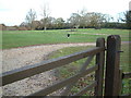
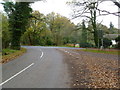
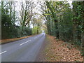
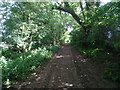
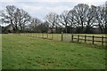
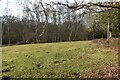
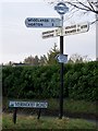

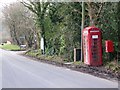
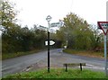
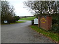
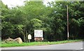
19 photos from this area
Area Information
Key information about the BH21 8LJ including its size, population, and administrative classification.
- Area Type
- Postcode
- Area Size
- 49.2 hectares
- Population
- 2160
- Population Density
- 32 people/km²
House Prices in BH21 8LJ
28
Properties
£517,813
Average Sold Price
£185,000
Lowest Price
£835,000
Highest Price
Showing 28 properties
| Address | Type | Beds | Baths | Last Sale Price | Last Sale Date | |
|---|---|---|---|---|---|---|
| Highlands, Verwood Road, Woodlands, BH21 8LJ | Bungalow | - | - | £675,000 | Jan 2023 | |
| Hedgerow, Verwood Road, Woodlands, BH21 8LJ | house | - | - | £495,000 | Aug 2021 | |
| Bryher, Verwood Road, Woodlands, BH21 8LJ | Detached | 4 | 3 | £580,000 | Mar 2021 | |
| Firview, Verwood Road, Woodlands, BH21 8LJ | Detached | - | - | £665,000 | Mar 2021 | |
| Woodfield, Verwood Road, Woodlands, BH21 8LJ | house | - | - | £645,000 | Mar 2021 | |
| Copperfields, Verwood Road, Woodlands, BH21 8LJ | Bungalow | - | - | £520,000 | Feb 2021 | |
| Embers, Verwood Road, Woodlands, BH21 8LJ | Bungalow | 4 | 2 | £610,000 | Nov 2020 | |
| Hartfield, Verwood Road, Woodlands, BH21 8LJ | Detached | 3 | - | £835,000 | Jul 2018 | |
| High Point, Verwood Road, Woodlands, BH21 8LJ | Bungalow | 5 | 2 | £630,000 | Aug 2017 | |
| Cinders, Verwood Road, Woodlands, BH21 8LJ | Detached | 4 | 3 | £555,000 | Jun 2017 |
Page 1 of 3
Energy Efficiency in BH21 8LJ
Amenities
Schools
| Rank | School | Type | Entry gender | Ages |
|---|
Explore more schools in this area
Go to Schools tabDemographics
Household Size
Two person
most common
Accommodation Type
Houses
most common
Tenure
56
majority
Ethnic Group
White
most common
Religion
N/A
most common
Household Composition
N/A
most common
Age
47
median
Adults (30-64 years)
most common
Household Deprivation
N/A
with no deprivation
NS-SEC
34
in Lower managerial occupations
Explore more demographic insights in this area
Go to Demographics tabPlanning
Planning Constraints
- Flood RiskPremium
- Ramsar Wetland SitesPremium
- Area of Outstanding Natural BeautyPremium
- Protected Nature ReservePremium
- Protected WoodlandPremium