Area Overview for BH21 7YJ
Photos of BH21 7YJ
Area Information
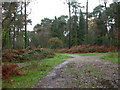
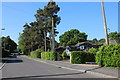
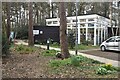
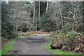
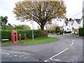
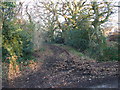
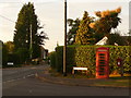
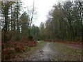
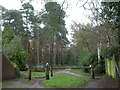
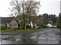
BH21 7YJ is a small residential postcode area in south-east Dorset, nestled within a semi-rural setting that blends suburban convenience with natural charm. With a population of 1,512 and a density of 952 people per square kilometre, it reflects a tight-knit community. The area’s character stems from its history as a medieval hamlet that expanded during the Victorian era, driven by railway development and affluent estates. Today, it offers a mix of well-wooded common land, village green spaces like Triangle Woods, and recent housing projects such as Cranborne Road’s 630 new homes. Residents benefit from proximity to Bournemouth Airport and nearby rail stations, ensuring easy access to regional hubs. The area’s low crime risk and absence of environmental constraints make it appealing for families and professionals seeking a balance between tranquillity and connectivity. Living here means embracing a community with a strong local identity, where historical landmarks like St Michael’s Church and leisure spaces like Oliver’s Park coexist with modern amenities.
- Area Type
- Postcode
- Area Size
- Not available
- Population
- 1512
- Population Density
- 952 people/km²
The property market in BH21 7YJ is characterised by a high rate of home ownership (71%) and a predominance of houses over flats or apartments. This suggests a market skewed towards owner-occupied properties, with limited rental activity. The presence of houses rather than high-density housing indicates a focus on traditional, often larger homes, which may appeal to families or professionals seeking space. Given the area’s small size and proximity to Bournemouth and Wimborne, property values are likely influenced by the balance between rural tranquillity and access to regional amenities. Buyers should consider the limited number of properties available, as the area is a small cluster. The mix of older homes and newer developments, such as the 630 homes along Cranborne Road, offers variety but may also mean competition for available listings.
House Prices in BH21 7YJ
No properties found in this postcode.
Energy Efficiency in BH21 7YJ
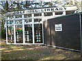
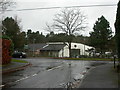
BH21 7YJ offers a blend of practical amenities and natural spaces. Within walking distance are five retail outlets, including Co-op Colehill and Spar, providing essentials for daily life. The area’s proximity to Bournemouth Airport and two rail stations ensures easy travel for both leisure and business. Locally, Triangle Woods and Leigh Common Local Nature Reserve offer green spaces for walking, cycling, and recreation, while Oliver’s Park and Cannon Hill’s Forestry England plantation cater to outdoor enthusiasts. The village green status of Triangle Woods reinforces a community focus on shared public spaces. This mix of retail, transport, and natural amenities creates a lifestyle that balances convenience with the tranquillity of semi-rural living, ideal for those seeking a self-contained yet connected environment.
Amenities
Schools
| Rank | School | Type | Entry gender | Ages |
|---|
Explore more schools in this area
Go to Schools tabDemographics
The population of BH21 7YJ is predominantly adults aged 30–64, with a median age of 47, reflecting a mature, stable community. Home ownership is high at 71%, indicating a mix of long-term residents and owner-occupied properties. The area is primarily composed of houses, not flats or apartments, suggesting a preference for traditional family homes. The predominant ethnic group is White, aligning with broader regional demographics. The relatively low population density of 952 people per square kilometre implies a less crowded environment compared to urban centres. This demographic profile suggests a community focused on settled living, with fewer young families or transient populations. The age distribution also points to a workforce likely engaged in local or regional employment, supported by nearby transport links.
Household Size
Accommodation Type
Tenure
Ethnic Group
Religion
Household Composition
Age
Household Deprivation
NS-SEC
Explore more demographic insights in this area
Go to Demographics tabPlanning
Planning Constraints
- Flood RiskPremium
- Ramsar Wetland SitesPremium
- Area of Outstanding Natural BeautyPremium
- Protected Nature ReservePremium
- Protected WoodlandPremium