Area Overview for BH21 7YE
Photos of BH21 7YE
Area Information
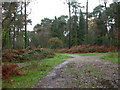
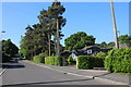
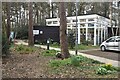
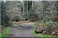
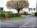
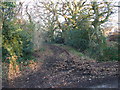
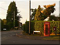
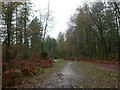
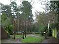
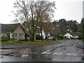
Living in BH21 7YE means inhabiting a small, tightly knit residential cluster in south-east Dorset, where the population of 1,512 is spread across a dense but compact area at 952 people per square kilometre. This postcode lies within the historic village of Colehill, a semi-rural settlement with roots in medieval times and Victorian expansion driven by railways and estates. The area retains a village character, with common land, wooded areas, and a community feel reinforced by its village green status at Triangle Woods. Residents benefit from proximity to nearby towns like Wimborne Minster and Bournemouth, offering a balance of quiet living and accessible amenities. The area’s recent development, including new housing along Cranborne Road, reflects its growing appeal, though it remains rooted in its heritage. For those seeking a place with a low crime rate and minimal environmental constraints, BH21 7YE offers a stable, family-oriented environment. Its small size means a close-knit community, where local landmarks like St Michael’s Church and Leigh Common Nature Reserve contribute to a sense of place.
- Area Type
- Postcode
- Area Size
- Not available
- Population
- 1512
- Population Density
- 952 people/km²
The property market in BH21 7YE is dominated by owner-occupied homes, with 71% of properties owned by residents rather than rented. This high home ownership rate suggests a community of long-term residents and a stable market with limited turnover. The accommodation type is primarily houses, which is typical for semi-rural areas and aligns with the area’s character as a village with larger properties. For buyers, this means a market that prioritises private ownership over rental investment, potentially offering better long-term value. The small size of the postcode area means the housing stock is limited, with recent developments like the 630 homes along Cranborne Road and 350 homes south of Leigh Road A31 expanding the available options. However, the focus on houses rather than flats or apartments may appeal to those seeking space and privacy. Buyers should consider the area’s proximity to Bournemouth and Wimborne for additional property choices beyond the immediate postcode.
House Prices in BH21 7YE
No properties found in this postcode.
Energy Efficiency in BH21 7YE
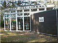
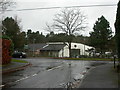
Life in BH21 7YE is shaped by its mix of local amenities and nearby towns. Within practical reach are retail options like Co-op Colehill and Spar, providing essential shopping. The area’s semi-rural character is complemented by leisure spaces such as Triangle Woods, a village green with a war memorial, and Leigh Common Local Nature Reserve, offering walking and outdoor activities. Oliver’s Park and Forestry England’s Cannon Hill plantation provide additional green spaces for recreation. The proximity to Bournemouth and Wimborne means residents can access larger retail, dining, and cultural options. The presence of St Michael’s Church and historic sites like the Tin Tabernacle reflect the area’s heritage. This blend of local convenience, natural spaces, and nearby urban centres creates a lifestyle that balances tranquillity with accessibility, ideal for those who value both community and connectivity.
Amenities
Schools
| Rank | School | Type | Entry gender | Ages |
|---|
Explore more schools in this area
Go to Schools tabDemographics
The community in BH21 7YE is predominantly middle-aged, with a median age of 47 and the most common age range being adults aged 30–64. This suggests a population that is largely established, with fewer young families or elderly residents. Home ownership is high at 71%, indicating a stable, long-term resident base. The accommodation type is primarily houses, which aligns with the semi-rural character of the area and the presence of larger properties in the housing stock. The predominant ethnic group is White, reflecting the broader demographic patterns of rural Dorset. With a population density of 952 people per square kilometre, the area is neither sprawling nor overly congested, offering a middle ground between urban and rural living. The absence of specific data on deprivation means the quality of life is inferred from the low crime rate and minimal environmental constraints, suggesting a generally comfortable standard of living for residents.
Household Size
Accommodation Type
Tenure
Ethnic Group
Religion
Household Composition
Age
Household Deprivation
NS-SEC
Explore more demographic insights in this area
Go to Demographics tabPlanning
Planning Constraints
- Flood RiskPremium
- Ramsar Wetland SitesPremium
- Area of Outstanding Natural BeautyPremium
- Protected Nature ReservePremium
- Protected WoodlandPremium