Area Overview for BH21 7EE
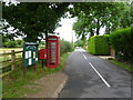
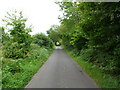
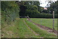
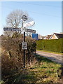
Photos of BH21 7EE

Area Information
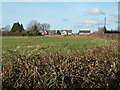
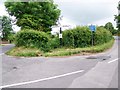
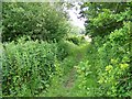
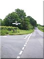
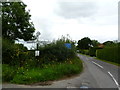
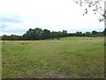
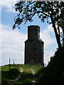
Living in BH21 7EE, a small residential cluster in east Dorset, offers a quiet, rural lifestyle surrounded by countryside. With a population of 2,406 and a low density of 56 people per square kilometre, the area feels spacious and uncluttered. This postcode falls within the Stour and Allen Vale ward, encompassing nearby villages like Hinton Martell and Horton. The village of Holt, which this area borders, has a long history dating back to the 13th century, with a church rebuilt in 1834 and a village hall built in 1935. Daily life here is defined by a strong sense of community, with local events like an annual fete and amenities such as a primary school, post office, and a pub known as The Old Inn. The surrounding landscape includes Holt Heath, a National Trust-owned heathland, offering open spaces for walking or recreation. While the area is rural, it is within practical reach of Wimborne Minster, providing access to larger services without sacrificing the tranquillity of village life.
- Area Type
- Postcode
- Area Size
- Not available
- Population
- 2406
- Population Density
- 56 people/km²
The property market in BH21 7EE is dominated by owner-occupied homes, with 83% of properties owned by residents rather than rented. This high home ownership rate indicates a community of long-term residents, many of whom may have purchased properties as family homes. The accommodation type is primarily houses, which is typical for rural areas where larger properties are common. Given the small size of the postcode area, the housing stock is limited, meaning buyers may need to consider nearby villages like Hinton Martell or Horton for additional options. The presence of houses rather than flats or apartments suggests a focus on spacious, traditional living. For buyers, this means a market with fewer high-density developments but potentially more characterful properties, though the limited supply could make competition for available homes more intense.
House Prices in BH21 7EE
No properties found in this postcode.
Energy Efficiency in BH21 7EE
The lifestyle in BH21 7EE is defined by a blend of rural tranquillity and local amenities. Within practical reach are five retail outlets, including Spar, Co-op Colehill, and The Southern Co-operative, providing everyday shopping needs. The village of Holt, which this postcode borders, offers a village hall, post office, and a pub known as The Old Inn, serving as social hubs. The annual fete and other community events foster a sense of local identity. Nearby, Holt Heath—a National Trust-owned heathland—offers open spaces for walking, cycling, or wildlife observation. While the area lacks large supermarkets or cinemas, its proximity to Wimborne Minster ensures access to more extensive services. The combination of small-scale retail, community facilities, and natural spaces creates a convenient, low-stress environment ideal for those seeking a slower pace of life without sacrificing accessibility.
Amenities
Schools
Residents of BH21 7EE have access to a range of educational options, including St James’ Church of England Voluntary Controlled First School, a primary school serving the local community. Nearby is High Lea School, an independent institution offering alternative educational pathways. Additionally, St James Church of England First School, an academy with an Ofsted rating of ‘good’, provides further primary education. The mix of state, independent, and academy schools offers families flexibility in choosing their child’s education. The presence of a primary school within the area ensures convenient access to early years education, while the independent school caters to those seeking alternative curricula or smaller class sizes. The ‘good’ Ofsted rating at the academy suggests a reliable standard of teaching, though parents may still need to consider travel times for secondary education, which is likely located in Wimborne Minster.
| Rank | School | Type | Entry gender | Ages |
|---|
Explore more schools in this area
Go to Schools tabDemographics
The community in BH21 7EE is predominantly middle-aged, with a median age of 47 and the most common age range being adults aged 30–64. Home ownership is high at 83%, reflecting a stable, long-term resident base. The area is characterised by houses rather than flats or apartments, suggesting larger properties typical of rural settlements. The predominant ethnic group is White, with no specific data on other demographics. The low population density of 56 people per square kilometre indicates spacious living conditions, which align with the rural character of the area. This demographic profile suggests a community focused on family life and long-term residency, with limited reliance on rental housing. The absence of detailed diversity data means the area’s social composition is largely homogenous, though this does not necessarily imply a lack of inclusivity.
Household Size
Accommodation Type
Tenure
Ethnic Group
Religion
Household Composition
Age
Household Deprivation
NS-SEC
Explore more demographic insights in this area
Go to Demographics tabPlanning
Planning Constraints
- Flood RiskPremium
- Ramsar Wetland SitesPremium
- Area of Outstanding Natural BeautyPremium
- Protected Nature ReservePremium
- Protected WoodlandPremium