Area Overview for BH21 7DF
Photos of BH21 7DF

Area Information
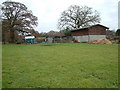
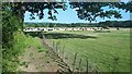
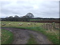
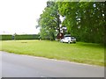
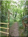
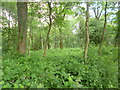
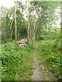
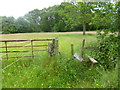
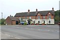
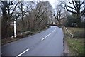
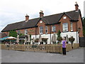
BH21 7DF is a small residential postcode in east Dorset, encompassing the village of Holt, a rural settlement just 2 miles north of Wimborne Minster. With a population of 2,406 spread across 3.2 hectares, the area maintains a low density of 56 people per square kilometre, reflecting its quiet, idyllic character. Holt is a village with a strong sense of community, centred around its village hall, primary school, and The Old Inn pub. Annual events like a fete reinforce local ties. The area is surrounded by countryside, with Holt Heath—a National Trust-managed heathland—offering natural beauty. The village’s history dates to the 13th century, with a 14th-century church and listed buildings adding to its charm. Living here means a peaceful, rural lifestyle with easy access to nearby towns and the coast.
- Area Type
- Postcode
- Area Size
- 3.2 hectares
- Population
- 2406
- Population Density
- 56 people/km²
BH21 7DF is primarily an owner-occupied area, with 83% of homes owned by residents rather than rented. The accommodation type is predominantly houses, which aligns with the rural, low-density nature of the village. This suggests a market dominated by larger, family-friendly properties rather than apartments or flats. Given the small size of the postcode area, the housing stock is limited, and buyers may need to consider nearby villages like Hinton Martell or Horton for additional options. The high home ownership rate indicates a stable, long-term resident base, which can be a positive for property value retention. However, the limited number of homes may mean competition for available properties, particularly for those seeking specific features like proximity to the village centre or natural amenities like Holt Heath.
House Prices in BH21 7DF
Showing 2 properties
| Address | Type | Beds | Baths | Last Sale Price | Last Sale Date | |
|---|---|---|---|---|---|---|
| Phoenix Centre, Stewarts Country Garden Centre, Gods Blessing Lane, Holt, BH21 7DF | shop | - | - | - | - | |
| Broomhill Garden Buildings, Stewarts Country Garden Centre, Gods Blessing Lane, Holt, BH21 7DF | office_workshop | - | - | - | - |
Energy Efficiency in BH21 7DF
Life in BH21 7DF is centred around Holt’s village amenities, including a post office, The Old Inn pub, and a village hall that hosts community events. Retail options include Spar and Co-op Colehill, providing basic grocery needs. The area’s rural setting is complemented by Holt Heath, a National Trust reserve offering walks and wildlife. The village’s character is defined by its historic buildings, such as the 14th-century Church of St. James and the 17th-century Holt Farmhouse. The combination of natural beauty, local shops, and community events creates a convenient, low-stress lifestyle. Residents benefit from easy access to nearby towns for more extensive shopping or services, while the village itself offers a self-contained, idyllic environment.
Amenities
Schools
The area is served by three schools: St James’ Church of England Voluntary Controlled First School, a primary school; High Lea School, an independent institution; and St James Church of England First School, an academy with a Good Ofsted rating. This mix of school types provides families with options, from state-funded education to independent schooling. The presence of an academy with a Good rating suggests a reliable standard of education, while the independent school caters to those seeking alternative curricula or smaller class sizes. The proximity of these schools to the village centre makes them easily accessible for local residents. Families with children benefit from a range of educational choices, though the small area means these schools serve a broader regional catchment beyond BH21 7DF.
| Rank | School | Type | Entry gender | Ages |
|---|
Explore more schools in this area
Go to Schools tabDemographics
The population of BH21 7DF is predominantly adults aged 30–64, with a median age of 47. This suggests a mature, stable community with a focus on family life and long-term residency. Home ownership is high at 83%, indicating a strong presence of owner-occupied properties rather than rentals. The area is characterised by houses rather than flats, reflecting its rural, low-density nature. The predominant ethnic group is White, though no further breakdown of diversity is provided. The low population density of 56 people per square kilometre implies a spread-out, less congested environment, which may appeal to those seeking space and tranquillity. This demographic profile suggests a community that values stability, with fewer transient residents and a focus on established households.
Household Size
Accommodation Type
Tenure
Ethnic Group
Religion
Household Composition
Age
Household Deprivation
NS-SEC
Explore more demographic insights in this area
Go to Demographics tabPlanning
Planning Constraints
- Flood RiskPremium
- Ramsar Wetland SitesPremium
- Area of Outstanding Natural BeautyPremium
- Protected Nature ReservePremium
- Protected WoodlandPremium