Area Overview for BH21 6ST
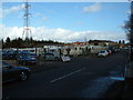
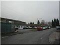
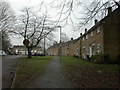
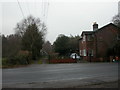
Photos of BH21 6ST


Area Information
BH21 6ST is a small residential postcode area in England, encompassing a compact cluster of homes within the village of West Moors. With a population of 1,315 spread across 1.9 hectares, it reflects a low-density, suburban character typical of commuter villages. Positioned on the northern edge of the Poole-Bournemouth conurbation, the area benefits from proximity to major towns like Bournemouth, just 10 miles away, and larger natural attractions such as the Jurassic Coast and New Forest National Park. West Moors itself is a historic settlement, shaped by its railway heritage from the 19th century, with a modest village centre anchored by its parish church and community institutions. Daily life here is defined by its role as a commuter hub, with residents frequently traveling to nearby cities for work. The area’s charm lies in its quiet residential appeal, blending rural tranquility with access to urban amenities, making it suitable for those seeking a balance between seclusion and connectivity.
- Area Type
- Postcode
- Area Size
- 1.9 hectares
- Population
- 1315
- Population Density
- 332 people/km²
BH21 6ST is primarily an owner-occupied area, with 80% of homes owned by residents rather than rented. The accommodation type is exclusively houses, which is unusual for many modern residential areas that include flats or apartments. This suggests a housing stock tailored to family homes, likely with larger plots and traditional layouts. Given the small area size of 1.9 hectares and a population of 1,315, the number of properties is limited, meaning the local market is likely constrained. Buyers should consider nearby areas for broader options, though the existing stock offers a distinct, low-density living experience. The high home ownership rate indicates strong community ties, but the lack of rental properties may limit flexibility for those seeking short-term housing solutions.
House Prices in BH21 6ST
No properties found in this postcode.
Energy Efficiency in BH21 6ST
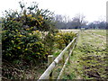
Residents of BH21 6ST have access to five retail outlets within practical reach, including Spar, Tesco West, and Morrisons Daily, ensuring convenience for everyday shopping. The area’s proximity to Bournemouth and other nearby towns expands leisure and dining options beyond the village. The Castleman Trailway, a former railway path, provides a scenic route for walking or cycling, connecting to Poole and Ringwood. While the data does not specify parks or recreational facilities within the postcode itself, the surrounding natural beauty of the Jurassic Coast and New Forest National Park offers opportunities for outdoor activities. The village’s historic character, including its parish church and remnants of the railway era, adds to its distinctiveness. Overall, the lifestyle here balances suburban convenience with access to natural and cultural amenities.
Amenities
Schools
The area is served by two primary schools: West Moors, St Mary’s Church of England Voluntary Controlled First School and St Mary’s CofE First School & Nursery. Both institutions cater to younger children, with the first listed as a traditional Church of England school and the second designated as an academy. The presence of two primary schools suggests a focus on early education, though no secondary schools are mentioned in the data. Families with young children will find these options convenient, though the absence of secondary education facilities may require commuting to nearby towns like Bournemouth or Ferndown. The mix of school types offers parents choices between traditional and academically focused environments, though specific performance metrics or Ofsted ratings are not provided.
| Rank | School | Type | Entry gender | Ages |
|---|
Explore more schools in this area
Go to Schools tabDemographics
The population of BH21 6ST has a median age of 47, with the majority of residents falling within the 30–64 age range. This suggests a mature, stable community with a strong presence of working-age adults. Home ownership is high, at 80%, indicating a preference for long-term residency over rental properties. The accommodation type is predominantly houses, reflecting a traditional, family-oriented housing stock. The predominant ethnic group is White, though no specific data on diversity or deprivation is provided. The age profile and home ownership rates imply a community focused on stability and established living, with fewer young families or transient populations. The absence of detailed diversity statistics means the area’s social composition remains largely unexplored in the data, but the demographic trends point to a cohesive, middle-aged population.
Household Size
Accommodation Type
Tenure
Ethnic Group
Religion
Household Composition
Age
Household Deprivation
NS-SEC
Explore more demographic insights in this area
Go to Demographics tabPlanning
Planning Constraints
- Flood RiskPremium
- Ramsar Wetland SitesPremium
- Area of Outstanding Natural BeautyPremium
- Protected Nature ReservePremium
- Protected WoodlandPremium