Area Overview for BH21 5QT
Photos of BH21 5QT
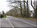
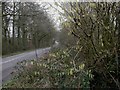
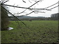
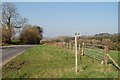
19 photos from this area
Area Information
Key information about the BH21 5QT including its size, population, and administrative classification.
- Area Type
- Postcode
- Area Size
- 67.6 hectares
- Population
- 2160
- Population Density
- 32 people/km²
House Prices in BH21 5QT
29
Properties
£377,143
Average Sold Price
£64,000
Lowest Price
£775,000
Highest Price
Showing 29 properties
| Address | Type | Beds | Baths | Last Sale Price | Last Sale Date | |
|---|---|---|---|---|---|---|
| Gold Oak Farmhouse, Hare Lane, Cranborne, BH21 5QT | Detached | 4 | 2 | £775,000 | Mar 2022 | |
| Maytime, Hare Lane, Cranborne, BH21 5QT | Bungalow | - | - | £380,000 | Sep 2018 | |
| Greensleeves, Hare Lane, Cranborne, BH21 5QT | Bungalow | 2 | - | £292,000 | May 2016 | |
| Corner House, Hare Lane, Cranborne, BH21 5QT | Detached | 4 | 3 | £495,000 | May 2015 | |
| Florian, Hare Lane, Cranborne, BH21 5QT | Bungalow | 2 | - | £360,000 | Feb 2014 | |
| Rose House, Hare Lane, Cranborne, BH21 5QT | Detached | - | - | £274,000 | Dec 1998 | |
| Tudor House, Hare Lane, Cranborne, BH21 5QT | Detached | - | - | £64,000 | Dec 1996 | |
| Hare Lane Pottery, Hare Lane, Cranborne, BH21 5QT | Detached | 2 | - | - | - | |
| Gold Oak Bungalow, Hare Lane, Cranborne, BH21 5QT | house | 5 | - | - | - | |
| Songbird, Hare Lane, Cranborne, BH21 5QT | Bungalow | - | - | - | - |
Page 1 of 3
Energy Efficiency in BH21 5QT
Amenities
Schools
| Rank | School | Type | Entry gender | Ages |
|---|
Explore more schools in this area
Go to Schools tabDemographics
Household Size
Two person
most common
Accommodation Type
Houses
most common
Tenure
56
majority
Ethnic Group
White
most common
Religion
N/A
most common
Household Composition
N/A
most common
Age
47
median
Adults (30-64 years)
most common
Household Deprivation
N/A
with no deprivation
NS-SEC
34
in Lower managerial occupations
Explore more demographic insights in this area
Go to Demographics tabPlanning
Planning Constraints
- Flood RiskPremium
- Ramsar Wetland SitesPremium
- Area of Outstanding Natural BeautyPremium
- Protected Nature ReservePremium
- Protected WoodlandPremium