Area Overview for BH21 4JP
Photos of BH21 4JP
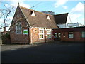
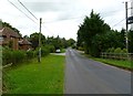
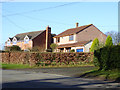
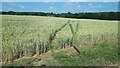
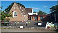
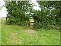
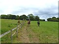
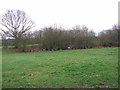
9 photos from this area
Area Information
Key information about the BH21 4JP including its size, population, and administrative classification.
- Area Type
- Postcode
- Area Size
- 26.5 hectares
- Population
- 2406
- Population Density
- 56 people/km²
House Prices in BH21 4JP
12
Properties
£519,833
Average Sold Price
£146,500
Lowest Price
£770,000
Highest Price
Showing 12 properties
| Address | Type | Beds | Baths | Last Sale Price | Last Sale Date | |
|---|---|---|---|---|---|---|
| Primrose Cottage, Horseshoes To Gaunts Common Lane, Gaunts Common, BH21 4JP | house | - | - | £762,500 | Jun 2021 | |
| Cutlers Farmhouse, Horseshoes To Gaunts Common Lane, Gaunts Common, BH21 4JP | house | 3 | - | £770,000 | Sep 2014 | |
| Capricorn Cottage, Horseshoes To Gaunts Common Lane, Gaunts Common, BH21 4JP | Detached | - | - | £515,000 | Nov 2011 | |
| Yew Tree Cottage, Horseshoes To Gaunts Common Lane, Gaunts Common, BH21 4JP | Detached | - | - | £330,000 | Mar 2005 | |
| Rose Cottage, Horseshoes To Gaunts Common Lane, Gaunts Common, BH21 4JP | Detached | - | - | £595,000 | Apr 2004 | |
| Bay Tree House, Horseshoes To Gaunts Common Lane, Gaunts Common, BH21 4JP | house | - | - | £146,500 | Jun 1996 | |
| The Hatch, Horseshoes To Gaunts Common Lane, Gaunts Common, BH21 4JP | Detached | 5 | 3 | - | - | |
| Morning Rise, Horseshoes To Gaunts Common Lane, Gaunts Common, BH21 4JP | Detached | - | - | - | - | |
| Cherry Trees, Horseshoes To Gaunts Common Lane, Gaunts Common, BH21 4JP | Detached | - | - | - | - | |
| Sycamore House, Horseshoes To Gaunts Common Lane, Gaunts Common, BH21 4JP | house | - | - | - | - |
Page 1 of 2
Energy Efficiency in BH21 4JP
Amenities
Schools
| Rank | School | Type | Entry gender | Ages |
|---|
Explore more schools in this area
Go to Schools tabDemographics
Household Size
Two person
most common
Accommodation Type
Houses
most common
Tenure
83
majority
Ethnic Group
White
most common
Religion
N/A
most common
Household Composition
N/A
most common
Age
47
median
Adults (30-64 years)
most common
Household Deprivation
N/A
with no deprivation
NS-SEC
45
in Lower managerial occupations
Explore more demographic insights in this area
Go to Demographics tabPlanning
Planning Constraints
- Flood RiskPremium
- Ramsar Wetland SitesPremium
- Area of Outstanding Natural BeautyPremium
- Protected Nature ReservePremium
- Protected WoodlandPremium