Area Overview for BH21 4EL
Photos of BH21 4EL
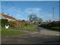
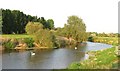
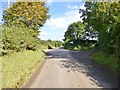
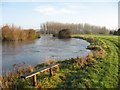
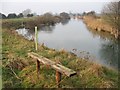
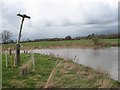
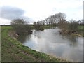
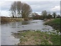
65 photos from this area
Area Information
Key information about the BH21 4EL including its size, population, and administrative classification.
- Area Type
- Postcode
- Area Size
- 1.4 km²
- Population
- 1259
- Population Density
- 27 people/km²
House Prices in BH21 4EL
21
Properties
£650,000
Average Sold Price
£650,000
Lowest Price
£650,000
Highest Price
Showing 21 properties
| Address | Type | Beds | Baths | Last Sale Price | Last Sale Date | |
|---|---|---|---|---|---|---|
| Farrs Coach House, Cowgrove Road, Pamphill, BH21 4EL | house | - | - | £650,000 | Mar 2021 | |
| 510 Cowgrove Road, Pamphill, BH21 4EL | Semi-detached | - | - | - | - | |
| Eyebridge Cottage, 511 Cowgrove Road, Pamphill, BH21 4EL | Semi-detached | - | - | - | - | |
| Drews Cottage, Cowgrove Road, Pamphill, BH21 4EL | house | - | - | - | - | |
| Poplar Farm Cottage, Roman Way To Cowgrove Track, Little Pamphill, BH21 4EL | house | - | - | - | - | |
| Farrs Lodge, Cowgrove Road, Pamphill, BH21 4EL | Bungalow | - | - | - | - | |
| Higher Dairy Farm, Cowgrove Road, Pamphill, BH21 4EL | Detached | - | - | - | - | |
| Wimborne Town Football Club, Cowgrove Road, Wimborne Minster, BH21 4EL | Leisure | - | - | - | - | |
| Walnut Farm, Cowgrove Road, Pamphill, BH21 4EL | Detached | - | - | - | - | |
| Lower Dairy Cottage, Cowgrove Road, Pamphill, BH21 4EL | Detached | - | - | - | - |
Page 1 of 3
Energy Efficiency in BH21 4EL
Amenities
Schools
| Rank | School | Type | Entry gender | Ages |
|---|
Explore more schools in this area
Go to Schools tabDemographics
Household Size
Two person
most common
Accommodation Type
Houses
most common
Tenure
42
majority
Ethnic Group
White
most common
Religion
N/A
most common
Household Composition
N/A
most common
Age
47
median
Adults (30-64 years)
most common
Household Deprivation
N/A
with no deprivation
NS-SEC
34
in Lower managerial occupations
Explore more demographic insights in this area
Go to Demographics tabPlanning
Planning Constraints
- Flood RiskPremium
- Ramsar Wetland SitesPremium
- Area of Outstanding Natural BeautyPremium
- Protected Nature ReservePremium