Area Overview for BH21 4BU
Photos of BH21 4BU
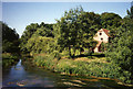
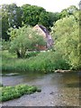
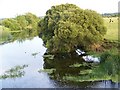
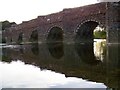
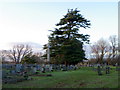
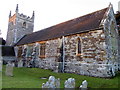
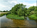
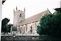
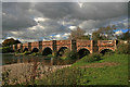

80 photos from this area
Area Information
Key information about the BH21 4BU including its size, population, and administrative classification.
- Area Type
- Postcode
- Area Size
- 27.1 hectares
- Population
- 1259
- Population Density
- 27 people/km²
House Prices in BH21 4BU
32
Properties
£334,823
Average Sold Price
£100,000
Lowest Price
£593,000
Highest Price
Showing 32 properties
| Address | Type | Beds | Baths | Last Sale Price | Last Sale Date | |
|---|---|---|---|---|---|---|
| 135 Church Street, Sturminster Marshall, BH21 4BU | Semi-detached | 3 | 1 | £440,000 | Jul 2025 | |
| 170 Church Street, Sturminster Marshall, BH21 4BU | Detached | 3 | 1 | £420,000 | Apr 2025 | |
| 162 Church Street, Sturminster Marshall, BH21 4BU | house | 3 | - | £593,000 | Sep 2023 | |
| 139 Church Street, Sturminster Marshall, BH21 4BU | Detached | 3 | 1 | £560,000 | Aug 2023 | |
| 184 Church Street, Sturminster Marshall, BH21 4BU | Terraced | 3 | 1 | £310,000 | May 2019 | |
| 180 Church Street, Sturminster Marshall, BH21 4BU | Terraced | 2 | 1 | £260,000 | Feb 2018 | |
| 166 Church Street, Sturminster Marshall, BH21 4BU | Detached | - | - | £350,000 | Oct 2017 | |
| 164 Church Street, Sturminster Marshall, BH21 4BU | Detached | 4 | 3 | £347,000 | Nov 2013 | |
| 176 Church Street, Sturminster Marshall, BH21 4BU | house | - | - | £201,050 | Feb 2012 | |
| 192 Church Street, Sturminster Marshall, BH21 4BU | house | - | - | £100,000 | Jan 2000 |
Page 1 of 4
Energy Efficiency in BH21 4BU
Amenities
Schools
| Rank | School | Type | Entry gender | Ages |
|---|
Explore more schools in this area
Go to Schools tabDemographics
Household Size
Two person
most common
Accommodation Type
Houses
most common
Tenure
42
majority
Ethnic Group
White
most common
Religion
N/A
most common
Household Composition
N/A
most common
Age
47
median
Adults (30-64 years)
most common
Household Deprivation
N/A
with no deprivation
NS-SEC
34
in Lower managerial occupations
Explore more demographic insights in this area
Go to Demographics tabPlanning
Planning Constraints
- Flood RiskPremium
- Ramsar Wetland SitesPremium
- Area of Outstanding Natural BeautyPremium
- Protected Nature ReservePremium
- Protected WoodlandPremium