Area Overview for BH21 3TL
Photos of BH21 3TL
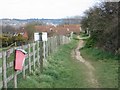
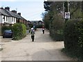
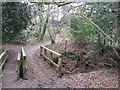
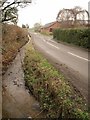


31 photos from this area
Area Information
Key information about the BH21 3TL including its size, population, and administrative classification.
- Area Type
- Postcode
- Area Size
- 8.2 hectares
- Population
- 1331
- Population Density
- 873 people/km²
House Prices in BH21 3TL
24
Properties
£305,125
Average Sold Price
£104,000
Lowest Price
£547,500
Highest Price
Showing 24 properties
| Address | Type | Beds | Baths | Last Sale Price | Last Sale Date | |
|---|---|---|---|---|---|---|
| 18 Stour View Gardens, Corfe Mullen, BH21 3TL | Bungalow | 2 | 1 | £325,000 | Jan 2024 | |
| 75 Stour View Gardens, Corfe Mullen, BH21 3TL | Retail | 4 | - | £547,500 | Jun 2022 | |
| 73 Stour View Gardens, Corfe Mullen, BH21 3TL | house | - | - | £500,000 | Aug 2021 | |
| 93 Stour View Gardens, Corfe Mullen, BH21 3TL | Bungalow | - | - | £350,000 | Apr 2021 | |
| 79 Stour View Gardens, Corfe Mullen, BH21 3TL | Bungalow | 4 | - | £495,000 | Sep 2019 | |
| 67 Stour View Gardens, Corfe Mullen, BH21 3TL | Bungalow | 2 | - | £322,500 | Sep 2018 | |
| 69 Stour View Gardens, Corfe Mullen, BH21 3TL | house | 4 | - | £472,500 | Sep 2017 | |
| 97 Stour View Gardens, Corfe Mullen, BH21 3TL | Bungalow | 2 | 1 | £345,000 | Aug 2015 | |
| 85 Stour View Gardens, Corfe Mullen, BH21 3TL | house | - | - | £389,000 | Aug 2015 | |
| 63 Stour View Gardens, Corfe Mullen, BH21 3TL | Bungalow | - | - | £237,000 | Oct 2012 |
Page 1 of 3
Energy Efficiency in BH21 3TL
Amenities
Schools
| Rank | School | Type | Entry gender | Ages |
|---|
Explore more schools in this area
Go to Schools tabDemographics
Household Size
Two person
most common
Accommodation Type
Houses
most common
Tenure
89
majority
Ethnic Group
White
most common
Religion
N/A
most common
Household Composition
N/A
most common
Age
47
median
Adults (30-64 years)
most common
Household Deprivation
N/A
with no deprivation
NS-SEC
40
in Lower managerial occupations
Explore more demographic insights in this area
Go to Demographics tabPlanning
Planning Constraints
- Flood RiskPremium
- Ramsar Wetland SitesPremium
- Area of Outstanding Natural BeautyPremium
- Protected Nature ReservePremium
- Protected WoodlandPremium