Area Overview for BH21 3AA
Photos of BH21 3AA
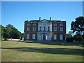
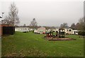
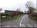
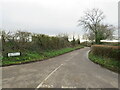

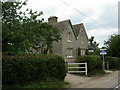
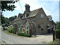
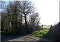
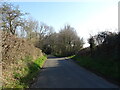

11 photos from this area
Area Information
Key information about the BH21 3AA including its size, population, and administrative classification.
- Area Type
- Postcode
- Area Size
- 65.9 hectares
- Population
- 1515
- Population Density
- 425 people/km²
House Prices in BH21 3AA
51
Properties
£1,188,750
Average Sold Price
£977,500
Lowest Price
£1,400,000
Highest Price
Showing 51 properties
| Address | Type | Beds | Baths | Last Sale Price | Last Sale Date | |
|---|---|---|---|---|---|---|
| Merley Mews, Merley House Lane, Poole, BH21 3AA | house | - | - | £977,500 | Jun 2023 | |
| Pear Tree Cottage, Merley House Lane, Poole, BH21 3AA | Detached | - | - | £1,400,000 | Sep 2022 | |
| 33, Merley House Holiday Park, Merley House Lane, Poole, BH21 3AA | Mobile Home | 2 | 2 | - | - | |
| 20, Merley House Holiday Park, Merley House Lane, Poole, BH21 3AA | Mobile Home | 2 | 2 | - | - | |
| The Chalet, Merley House Lane, Poole, BH21 3AA | Mobile Home | 3 | 2 | - | - | |
| Merley Cottage, Merley House Lane, Poole, BH21 3AA | Mobile Home | 2 | 2 | - | - | |
| Silver Trees, Merley House Lane, Poole, BH21 3AA | Mobile Home | 2 | 1 | - | - | |
| Little Merley, Merley House Lane, Poole, BH21 3AA | Mobile Home | 2 | 2 | - | - | |
| 86, Merley House Holiday Park, Merley House Lane, Poole, BH21 3AA | Mobile Home | 3 | - | - | - | |
| 88, Merley House Holiday Park, Merley House Lane, Poole, BH21 3AA | Lodge | 2 | 2 | - | - |
Page 1 of 6
Energy Efficiency in BH21 3AA
Amenities
Schools
| Rank | School | Type | Entry gender | Ages |
|---|
Explore more schools in this area
Go to Schools tabDemographics
Household Size
Two person
most common
Accommodation Type
Houses
most common
Tenure
94
majority
Ethnic Group
White
most common
Religion
N/A
most common
Household Composition
N/A
most common
Age
47
median
Adults (30-64 years)
most common
Household Deprivation
N/A
with no deprivation
NS-SEC
46
in Lower managerial occupations
Explore more demographic insights in this area
Go to Demographics tabPlanning
Planning Constraints
- Flood RiskPremium
- Ramsar Wetland SitesPremium
- Area of Outstanding Natural BeautyPremium
- Protected Nature ReservePremium
- Protected WoodlandPremium