Area Overview for BH21 2YH
Photos of BH21 2YH
Area Information
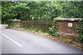
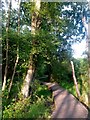
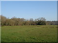
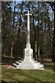
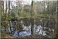
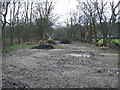
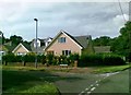
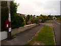
Living in BH21 2YH means being part of Colehill, a semi-rural village in south-east Dorset with a population of 1,246. The area’s density of 909 people per square kilometre reflects its compact residential cluster, blending suburban convenience with natural surroundings. Historically shaped by Victorian railway expansion and wealthy estates, Colehill retains a village green at Triangle Woods and a rebranded Town Council established in 2025 to safeguard green belt status. Daily life here balances proximity to amenities with access to heathland and woodland. Recent developments, such as new housing along Cranborne Road, reflect growing demand. The area’s character is defined by its mix of well-wooded common land and modern infrastructure, offering a quieter alternative to nearby towns while remaining within reach of Bournemouth’s airports and rail networks. Residents benefit from a community feel, with local landmarks like St Michael’s Church and Oliver’s Park adding to the area’s charm.
- Area Type
- Postcode
- Area Size
- Not available
- Population
- 1246
- Population Density
- 909 people/km²
BH21 2YH is overwhelmingly an owner-occupied area, with 92% of homes owned by residents rather than rented. The accommodation type is predominantly houses, reflecting the semi-rural nature of Colehill. This suggests a market focused on family homes rather than apartments or flats. Given the area’s small size and high home ownership, property availability is limited, making it a niche market for buyers seeking stability in a low-density setting. The presence of new housing developments, such as those along Cranborne Road, indicates growth but also competition for existing properties. Buyers should consider the area’s limited size and the importance of proximity to local amenities when evaluating potential purchases.
House Prices in BH21 2YH
No properties found in this postcode.
Energy Efficiency in BH21 2YH
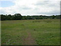
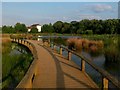
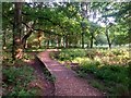
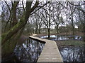
The lifestyle in BH21 2YH combines practical amenities with natural spaces. Within practical reach are five retail venues, including Co-op Colehill and Spar Gordon, offering daily essentials. The area’s proximity to Bournemouth’s airports and rail stations enhances its accessibility. Locally, Triangle Woods and Oliver’s Park provide green spaces for recreation, while Leigh Common Local Nature Reserve and Cannon Hill’s Forestry England plantation offer walking and cycling opportunities. The village green status of Triangle Woods and the semi-rural setting create a balance between convenience and tranquillity. Residents can enjoy both the charm of a small village and the connectivity of nearby urban centres.
Amenities
Schools
Residents of BH21 2YH have access to a range of educational institutions. St Michael’s Church of England Voluntary Aided Middle School, Colehill, serves primary education, while Beaucroft Foundation School caters to special needs. St Michael’s Church of England Middle School, Colehill, is an academy with an Ofsted rating of “good,” offering a broader curriculum. The mix of primary, special, and academy schools ensures families can find options tailored to their children’s needs. The presence of a high-performing academy and a foundation school highlights the area’s commitment to education, though no secondary schools are listed. Parents should consider the proximity of these schools to their homes when planning for their families’ future.
| Rank | School | Type | Entry gender | Ages |
|---|
Explore more schools in this area
Go to Schools tabDemographics
The population of BH21 2YH is predominantly adults aged 30–64, with a median age of 47. This suggests a stable, mature community with strong ties to the area. Home ownership is exceptionally high at 92%, indicating a long-term presence of residents rather than transient populations. The accommodation type is primarily houses, which aligns with the semi-rural character of the area. The predominant ethnic group is White, though no further diversity data is provided. The absence of specific deprivation statistics means no direct conclusions can be drawn about economic challenges, but the high home ownership and age profile suggest a relatively affluent, settled demographic.
Household Size
Accommodation Type
Tenure
Ethnic Group
Religion
Household Composition
Age
Household Deprivation
NS-SEC
Explore more demographic insights in this area
Go to Demographics tabPlanning
Planning Constraints
- Flood RiskPremium
- Ramsar Wetland SitesPremium
- Area of Outstanding Natural BeautyPremium
- Protected Nature ReservePremium
- Protected WoodlandPremium