Area Overview for BH21 2UW
Photos of BH21 2UW


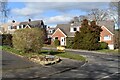


27 photos from this area
Area Information
Key information about the BH21 2UW including its size, population, and administrative classification.
- Area Type
- Postcode
- Area Size
- 2.2 hectares
- Population
- Not available
- Population Density
- Not available
House Prices in BH21 2UW
58
Properties
£280,632
Average Sold Price
£68,500
Lowest Price
£525,000
Highest Price
Showing 58 properties
| Address | Type | Beds | Baths | Last Sale Price | Last Sale Date | |
|---|---|---|---|---|---|---|
| 59 Canford View Drive, Colehill, BH21 2UW | house | 3 | 1 | £360,000 | Mar 2025 | |
| 12 Canford View Drive, Colehill, BH21 2UW | house | 3 | 1 | £390,000 | Mar 2025 | |
| 38 Canford View Drive, Colehill, BH21 2UW | house | - | - | £525,000 | Aug 2022 | |
| 48 Canford View Drive, Colehill, BH21 2UW | Detached | 4 | 1 | £400,000 | May 2022 | |
| 20 Canford View Drive, Colehill, BH21 2UW | Detached | 4 | - | £405,000 | Mar 2022 | |
| 45 Canford View Drive, Colehill, BH21 2UW | house | 3 | - | £405,000 | Oct 2021 | |
| 44 Canford View Drive, Colehill, BH21 2UW | house | - | - | £363,000 | Mar 2021 | |
| 33 Canford View Drive, Colehill, BH21 2UW | house | - | - | £410,000 | Jan 2021 | |
| 17 Canford View Drive, Colehill, BH21 2UW | house | - | - | £390,000 | Sep 2019 | |
| 3 Canford View Drive, Colehill, BH21 2UW | Detached | 4 | - | £412,000 | Mar 2017 |
Page 1 of 6
Energy Efficiency in BH21 2UW
Amenities
Schools
| Rank | School | Type | Entry gender | Ages |
|---|
Explore more schools in this area
Go to Schools tabDemographics
Household Size
Two person
most common
Accommodation Type
Houses
most common
Tenure
92
majority
Ethnic Group
White
most common
Religion
N/A
most common
Household Composition
N/A
most common
Age
47
median
Adults (30-64 years)
most common
Household Deprivation
N/A
with no deprivation
NS-SEC
49
in Lower managerial occupations
Explore more demographic insights in this area
Go to Demographics tabPlanning
Planning Constraints
- Flood RiskPremium
- Ramsar Wetland SitesPremium
- Area of Outstanding Natural BeautyPremium
- Protected Nature ReservePremium
- Protected WoodlandPremium