Area Overview for BH21 2AY
Photos of BH21 2AY

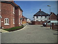
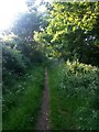
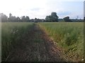
58 photos from this area
Area Information
Key information about the BH21 2AY including its size, population, and administrative classification.
- Area Type
- Postcode
- Area Size
- 2.0 hectares
- Population
- 2230
- Population Density
- 1668 people/km²
House Prices in BH21 2AY
53
Properties
£264,995
Average Sold Price
£76,000
Lowest Price
£380,000
Highest Price
Showing 53 properties
| Address | Type | Beds | Baths | Last Sale Price | Last Sale Date | |
|---|---|---|---|---|---|---|
| 41 Barnes Crescent, Wimborne Minster, BH21 2AY | Terraced | 3 | 2 | £380,000 | May 2025 | |
| 63 Barnes Crescent, Wimborne Minster, BH21 2AY | Terraced | 3 | 1 | £360,000 | Mar 2025 | |
| 43 Barnes Crescent, Wimborne Minster, BH21 2AY | Semi-detached | 2 | 1 | £294,000 | Nov 2024 | |
| 45A Barnes Crescent, Wimborne Minster, BH21 2AY | Terraced | 3 | 1 | £287,500 | Sep 2024 | |
| 19 Barnes Crescent, Wimborne Minster, BH21 2AY | Semi-detached | 3 | 1 | £350,000 | Dec 2023 | |
| 5 Barnes Crescent, Wimborne Minster, BH21 2AY | Semi-detached | 2 | 1 | £275,000 | May 2023 | |
| 41A Barnes Crescent, Wimborne Minster, BH21 2AY | Terraced | 3 | 1 | £335,000 | May 2023 | |
| 55A Barnes Crescent, Wimborne Minster, BH21 2AY | house | - | - | £300,000 | Sep 2022 | |
| 51A Barnes Crescent, Wimborne Minster, BH21 2AY | house | - | - | £325,000 | Jul 2022 | |
| 77 Barnes Crescent, Wimborne Minster, BH21 2AY | Terraced | 2 | 1 | £299,950 | Jul 2022 |
Page 1 of 6
Energy Efficiency in BH21 2AY
Amenities
Schools
| Rank | School | Type | Entry gender | Ages |
|---|
Explore more schools in this area
Go to Schools tabDemographics
Household Size
Family (3-5 people)
most common
Accommodation Type
Houses
most common
Tenure
48
majority
Ethnic Group
White
most common
Religion
N/A
most common
Household Composition
N/A
most common
Age
47
median
Adults (30-64 years)
most common
Household Deprivation
N/A
with no deprivation
NS-SEC
29
in Lower managerial occupations
Explore more demographic insights in this area
Go to Demographics tabPlanning
Planning Constraints
- Flood RiskPremium
- Ramsar Wetland SitesPremium
- Area of Outstanding Natural BeautyPremium
- Protected Nature ReservePremium
- Protected WoodlandPremium