Area Overview for BH21 1UY
Photos of BH21 1UY
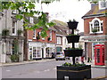
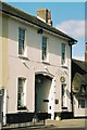
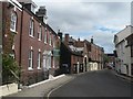
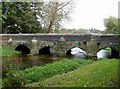
100 photos from this area
Area Information
Key information about the BH21 1UY including its size, population, and administrative classification.
- Area Type
- Postcode
- Area Size
- 1.9 hectares
- Population
- 1926
- Population Density
- 1380 people/km²
House Prices in BH21 1UY
20
Properties
£613,103
Average Sold Price
£351,630
Lowest Price
£755,000
Highest Price
Showing 20 properties
| Address | Type | Beds | Baths | Last Sale Price | Last Sale Date | |
|---|---|---|---|---|---|---|
| 18 Fallowfield Place, Wimborne, BH21 1UY | Detached | 3 | 2 | £532,500 | Jul 2025 | |
| 13 Fallowfield Place, Wimborne, BH21 1UY | house | 4 | - | £720,000 | Jan 2022 | |
| 9 Fallowfield Place, Wimborne, BH21 1UY | house | - | - | £750,000 | Dec 2021 | |
| 11 Fallowfield Place, Wimborne, BH21 1UY | house | - | - | £755,000 | Dec 2021 | |
| 7 Fallowfield Place, Wimborne, BH21 1UY | house | - | - | £625,000 | Dec 2021 | |
| 24 Fallowfield Place, Wimborne, BH21 1UY | Detached | 3 | 2 | £530,000 | Nov 2021 | |
| 1 Fallowfield Place, Wimborne, BH21 1UY | house | - | - | £675,000 | Nov 2021 | |
| 3 Fallowfield Place, Wimborne, BH21 1UY | house | - | - | £750,000 | Nov 2021 | |
| 22 Fallowfield Place, Wimborne, BH21 1UY | house | - | - | £530,000 | Sep 2021 | |
| 20 Fallowfield Place, Wimborne, BH21 1UY | house | - | - | £525,000 | Sep 2021 |
Page 1 of 2
Energy Efficiency in BH21 1UY
Amenities
Schools
| Rank | School | Type | Entry gender | Ages |
|---|
Explore more schools in this area
Go to Schools tabDemographics
Household Size
One person
most common
Accommodation Type
Houses
most common
Tenure
55
majority
Ethnic Group
White
most common
Religion
N/A
most common
Household Composition
N/A
most common
Age
47
median
Elderly (65+ years)
most common
Household Deprivation
N/A
with no deprivation
NS-SEC
39
in Lower managerial occupations
Explore more demographic insights in this area
Go to Demographics tabPlanning
Planning Constraints
- Flood RiskPremium
- Ramsar Wetland SitesPremium
- Area of Outstanding Natural BeautyPremium
- Protected Nature ReservePremium
- Protected WoodlandPremium