Area Overview for BH21 1HL
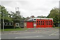
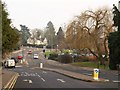
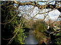
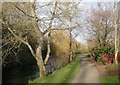
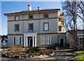
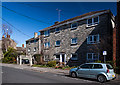
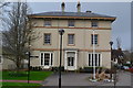
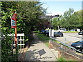
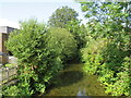
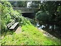
Photos of BH21 1HL
Area Information
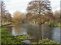
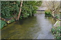
Living in BH21 1HL means inhabiting a small, tightly knit residential cluster in Wimborne Minster, Dorset. This postcode area spans 5,630 square metres and is home to 1,701 residents, giving it a population density of 543 people per square kilometre. The area is part of a historic market town at the confluence of the River Stour and River Allen, just five miles north of Poole. Its character is defined by its ancient parish church, a site of Benedictine heritage dating back over 1,300 years. Daily life here is shaped by proximity to local amenities, including independent schools, rail links, and a nearby airport. The community is predominantly middle-aged, with a median age of 47, and 81% of residents owning their homes. This suggests a stable, established population with a strong connection to the area. The low crime risk and absence of environmental constraints make BH21 1HL an attractive choice for those seeking a peaceful, historically rich setting with practical modern conveniences.
- Area Type
- Postcode
- Area Size
- 5630 m²
- Population
- 1701
- Population Density
- 543 people/km²
The property market in BH21 1HL is dominated by owner-occupied homes, with 81% of residents living in properties they own. The area is primarily composed of houses rather than flats or apartments, reflecting its small, residential nature. This suggests a market that caters to families and individuals seeking spacious, traditional housing rather than high-density developments. Given the area’s size and the prevalence of owner-occupation, the housing stock is likely limited in volume, making it a niche market for buyers. Those considering properties here should expect a focus on single-family homes, with limited rental availability. The proximity to Wimborne Minster and Poole may also influence property values, as buyers often seek a balance between historic charm and modern amenities.
House Prices in BH21 1HL
Showing 6 properties
| Address | Type | Beds | Baths | Last Sale Price | Last Sale Date | |
|---|---|---|---|---|---|---|
| 6 Royston Drive, Wimborne Minster, BH21 1HL | house | - | - | £660,000 | Nov 2022 | |
| 3 Royston Drive, Wimborne Minster, BH21 1HL | Detached | 4 | - | £650,000 | Jun 2020 | |
| 5 Royston Drive, Wimborne Minster, BH21 1HL | house | - | - | £310,000 | Aug 2010 | |
| 2 Royston Drive, Wimborne Minster, BH21 1HL | Detached | - | - | £185,000 | Apr 1999 | |
| 4 Royston Drive, Wimborne Minster, BH21 1HL | Detached | - | - | - | - | |
| 1 Royston Drive, Wimborne Minster, BH21 1HL | Detached | - | - | - | - |
Energy Efficiency in BH21 1HL
Residents of BH21 1HL enjoy a range of amenities within practical reach. The area is served by five retail outlets, including M&S Minster BP, Waitrose Wimborne, and Co-op Wimborne, offering everything from groceries to clothing. Three railway stations provide direct links to Poole and beyond, while Bournemouth Airport ensures easy travel. The historic Wimborne Minster church, with its Norman architecture and Saxon origins, adds cultural depth to daily life. The surrounding Dorset Heaths offer open spaces for walking or cycling, and the nearby River Stour and Allen provide scenic routes. This mix of retail, transport, and heritage sites creates a lifestyle that blends convenience with a connection to the area’s rich history.
Amenities
Schools
Residents of BH21 1HL have access to two independent schools: Dumpton School and Grangewood Hall School. Both are private institutions, offering education outside the state system. Independent schools often provide smaller class sizes, specialist facilities, and a focus on individualised learning. For families prioritising these features, the presence of two such schools within reach offers choice and flexibility. However, the absence of state schools in the data means that parents must consider the financial commitment and admissions processes associated with private education. This mix of school types caters to a community that may value tailored educational environments, though it may not suit those seeking publicly funded options.
| Rank | School | Type | Entry gender | Ages |
|---|
Explore more schools in this area
Go to Schools tabDemographics
The community in BH21 1HL is predominantly composed of adults aged 30–64, with a median age of 47. This reflects a mature, settled population, likely with established careers and families. Home ownership is high, at 81%, indicating a strong presence of long-term residents rather than transient renters. The area is characterised by houses rather than flats, which aligns with its residential, low-density profile. The predominant ethnic group is White, though specific data on diversity is not provided. The population density of 543 people per square kilometre suggests a balance between urban and rural living, with enough proximity to services without feeling overcrowded. This demographic profile points to a community that values stability, with a focus on family-oriented living and a lower likelihood of rapid demographic shifts.
Household Size
Accommodation Type
Tenure
Ethnic Group
Religion
Household Composition
Age
Household Deprivation
NS-SEC
Explore more demographic insights in this area
Go to Demographics tabPlanning
Planning Constraints
- Flood RiskPremium
- Ramsar Wetland SitesPremium
- Area of Outstanding Natural BeautyPremium
- Protected Nature ReservePremium
- Protected WoodlandPremium