Area Overview for BH20 7EA
Photos of BH20 7EA
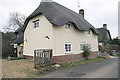
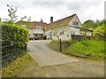
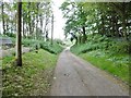
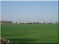
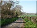
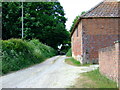
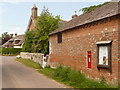
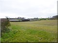

9 photos from this area
Area Information
Key information about the BH20 7EA including its size, population, and administrative classification.
- Area Type
- Postcode
- Area Size
- 3.9 km²
- Population
- 2076
- Population Density
- 117 people/km²
House Prices in BH20 7EA
20
Properties
£434,167
Average Sold Price
£252,500
Lowest Price
£610,000
Highest Price
Showing 20 properties
| Address | Type | Beds | Baths | Last Sale Price | Last Sale Date | |
|---|---|---|---|---|---|---|
| Kings Corner Barn, Down Street, West Morden, BH20 7EA | house | - | - | £440,000 | Nov 2018 | |
| Badgers Walk, 43 Kings Lane, West Morden, BH20 7EA | Detached | 4 | 3 | £610,000 | Mar 2017 | |
| Paddock Cottage, 38-39 Kings Lane, West Morden, BH20 7EA | Detached | - | - | £252,500 | May 1997 | |
| 40 Kings Lane, West Morden, BH20 7EA | Terraced | 2 | 1 | - | - | |
| 41 Kings Lane, West Morden, BH20 7EA | Terraced | 3 | 1 | - | - | |
| 42 Kings Lane, West Morden, BH20 7EA | Terraced | 3 | 1 | - | - | |
| West Morden House, Pound Wood Road, West Morden, BH20 7EA | Land | 4 | - | - | - | |
| Stables, Down Street, West Morden, BH20 7EA | Semi-detached | - | - | - | - | |
| Cart Shed, Down Street, West Morden, BH20 7EA | Semi-detached | - | - | - | - | |
| Wayside Cottage, 36 Kings Lane, West Morden, BH20 7EA | Detached | - | - | - | - |
Page 1 of 2
Energy Efficiency in BH20 7EA
Amenities
Schools
| Rank | School | Type | Entry gender | Ages |
|---|
Explore more schools in this area
Go to Schools tabDemographics
Household Size
Family (3-5 people)
most common
Accommodation Type
Houses
most common
Tenure
62
majority
Ethnic Group
White
most common
Religion
N/A
most common
Household Composition
N/A
most common
Age
47
median
Adults (30-64 years)
most common
Household Deprivation
N/A
with no deprivation
NS-SEC
36
in Lower managerial occupations
Explore more demographic insights in this area
Go to Demographics tabPlanning
Planning Constraints
- Flood RiskPremium
- Ramsar Wetland SitesPremium
- Area of Outstanding Natural BeautyPremium
- Protected Nature ReservePremium
- Protected WoodlandPremium