Area Overview for BH20 6YJ
Photos of BH20 6YJ
Area Information
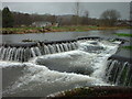
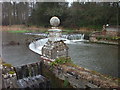
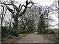
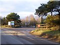
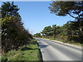
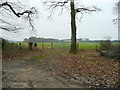
Living in BH20 6YJ means inhabiting a small, rural postcode area in Dorset, centred around East Stoke, a civil parish defined by agricultural land, flood plains, and historic sites. With a population of 1,314 and a density of 26 people per square kilometre, this is a low-density, spacious area where the landscape dominates daily life. The village sits along the A352 road, between Wool and Wareham, with the River Frome shaping its geography. Historically, East Stoke was a farming parish, though today it blends rural tranquillity with pockets of modern infrastructure. The area’s charm lies in its accessibility to nearby towns and its mix of natural and cultural features, such as the ruins of the 13th-century Church of St. Mary. For residents, life here balances a quiet, community-oriented rhythm with proximity to services and transport links. The postcode’s small size means a tight-knit feel, where familiarity with local landmarks and routines is part of everyday living.
- Area Type
- Postcode
- Area Size
- Not available
- Population
- 1314
- Population Density
- 26 people/km²
The property market in BH20 6YJ is dominated by owner-occupied homes, with 54% of properties owned by residents. The accommodation type is primarily houses, which is typical for rural areas with limited high-density development. This suggests a market geared towards families or individuals seeking spacious, traditional housing rather than flats or apartments. Given the small size of the postcode area, the housing stock is likely limited, with few new builds or developments. Buyers should consider that the area’s character—centred on rural living and proximity to natural features—may appeal to those prioritising space and tranquillity over urban amenities. The lack of rental-heavy properties indicates a stable, long-term resident base, though the limited number of homes could mean competition for available properties. For those seeking a home, the focus on houses aligns with a preference for private, low-density living, which is common in small, rural postcode areas like BH20 6YJ.
House Prices in BH20 6YJ
No properties found in this postcode.
Energy Efficiency in BH20 6YJ
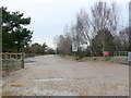
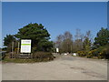
The lifestyle in BH20 6YJ is shaped by its rural setting and proximity to nearby amenities. Within practical reach are five retail venues, including Spar and Co-op Wareham, offering essential shopping and groceries. Three rail stations—Wool, Wareham, and Holton Heath—provide access to regional transport networks, while a metro station at Norden adds convenience for commuters. The area’s character is defined by its agricultural landscape, but its small size ensures residents can access services without long commutes. The presence of multiple shops and transport links supports a self-sufficient lifestyle, blending local traditions with modern needs. The nearby River Frome and historical sites, such as the ruins of the 13th-century church, also contribute to a sense of place. For those seeking a balance between tranquillity and accessibility, BH20 6YJ offers a mix of rural charm and practical amenities.
Amenities
Schools
Residents of BH20 6YJ have access to two primary schools: West Lulworth Church of England First School and Lulworth and Winfrith CofE VC Primary School, the latter of which holds an Ofsted rating of ‘good’. Both schools serve the local community, offering primary education for children aged 4–11. The presence of two primary schools provides families with options, though no secondary schools are listed in the data. The ‘good’ rating at Lulworth and Winfrith indicates a school with strong performance in areas such as pupil outcomes and teaching quality. For families with young children, the availability of these schools is a key consideration, as they are central to daily life in small villages. The proximity of the schools to the area suggests a walkable or short drive to education, reinforcing the community’s family-friendly character.
| Rank | School | Type | Entry gender | Ages |
|---|
Explore more schools in this area
Go to Schools tabDemographics
The community in BH20 6YJ is predominantly middle-aged, with a median age of 47 and the most common age range being adults aged 30–64. This suggests a stable, mature population, likely with established careers and families. Home ownership is strong, with 54% of properties owned by residents, compared to 46% rented. The area is characterised by houses rather than flats, reflecting a preference for detached or semi-detached living. The predominant ethnic group is White, though no specific data on diversity or deprivation is provided. The low population density of 26 people per square kilometre implies spacious, less crowded living conditions. This demographic profile indicates a community focused on long-term residency, with a mix of homeowners and renters, but no significant transient population. The age range also suggests a balance between active professionals and retirees, contributing to a steady local economy.
Household Size
Accommodation Type
Tenure
Ethnic Group
Religion
Household Composition
Age
Household Deprivation
NS-SEC
Explore more demographic insights in this area
Go to Demographics tabPlanning
Planning Constraints
- Flood RiskPremium
- Ramsar Wetland SitesPremium
- Area of Outstanding Natural BeautyPremium
- Protected Nature ReservePremium
- Protected WoodlandPremium